Neerbeek geodata
Neerbeek (Limburg) is a populated place; located in Netherlands in Europe/Amsterdam (GMT+2) time zone. With population of 2,480 people, there are 848 cities with bigger population in this country. Compared to other cities in Netherlands, 94.6% of cities are located further ↑North; 58.6% of cities are located further ←West and 95.4% of cities have lower elevation than Neerbeek. Note1


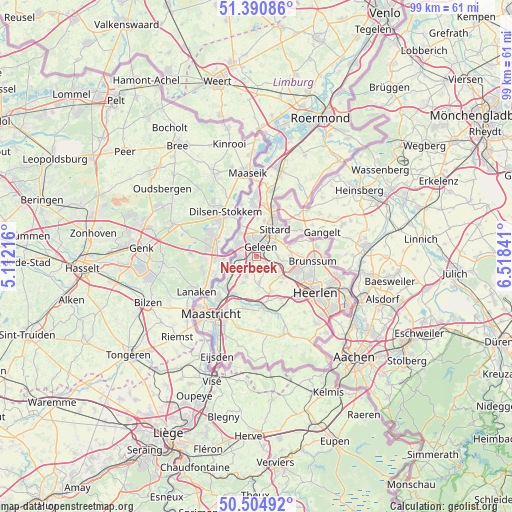
Neerbeek GPS coordinates[2]
50° 57' 0" North, 5° 48' 55.008" East
| Map corner | latitude | longitude |
|---|---|---|
| Upper-left | 51.39086°, | 5.11216° |
| Center: | 50.95°, | 5.81528° |
| Lower-right: | 50.50492°, | 6.51841° |
| Map W x H: | 98.5×98.5 km | = 61.2×61.2mi |
| max Lat: | 53.48025° ⇑94.6% North |
| Neerbeek: | 50.95° |
| min Lat: | ⇓5.4% South 50.76917° |
| min Long | Neerbeek | max Long |
| 3.38611° | 5.81528° | 7.16528° |
| W 58.6%⇐ | ⇒41.4% E |
Elevation
Elevation of Neerbeek is 72 m = 236 ft, and this is 57 m = 187 ft above average elevation for this country.
| Max E: |
203 m = 666 ft | 4.6% |
| Neerbeek | 72 m 236 ft | |
| Avg. | 15 m = 49 ft | |
Min E: |
-6 m = -20 ft | 95.4% |
See also: Netherlands elevation on elevation.city.
Geographical zone
Neerbeek is located in North temperate zone (between Tropic of Cancer and the Arctic Circle). Distance of this North polar circle is 1736.1 km =1078.8 mi to North.| Distance of | km | miles | from Neerbeek |
|---|---|---|---|
| North Pole | 4342 | 2698 | to North |
| Arctic Circle | 1736.1 | 1078.8 | to North |
| Tropic Cancer | 3059.2 | 1900.9 | to South |
| Equator | 5665.1 | 3520.1 | to South |


Nearby cities:
15 places around Neerbeek: (largest is in red/bold)
• Beek
1.6 km =1 mi,  231°
231°
• Catsop
3.6 km =2.2 mi,  250°
250°
• Elsloo
3.1 km =1.9 mi,  268°
268°
• Geleen
2.9 km =1.8 mi,  19°
19°
• Kerensheide
3.7 km =2.3 mi,  312°
312°
• Lindenheuvel
3.9 km =2.4 mi,  1°
1°
• Meers
5.3 km =3.3 mi,  284°
284°
• Munstergeleen
4.4 km =2.7 mi,  50°
50°
• Nieuwdorp
3.3 km =2.1 mi,  294°
294°
• Puth
4.1 km =2.5 mi,  83°
83°
• Schimmert
4.9 km =3 mi,  173°
173°
• Schinnen
5.2 km =3.2 mi,  98°
98°
• Spaubeek
2.2 km =1.4 mi,  119°
119°
• Stein
4 km =2.5 mi,  302°
302°
• Sweikhuizen
2.3 km =1.4 mi, 78°
Sources, notices
• [Note1] Compared only with cities in Netherlands existing in our database
• [Src1] Map data: © OpenStreetMap contributors (CC-BY-SA)
• [Src2] Other city data from geonames.org with taken over terms of usage.
• [Src3] Geographical zone / Annual Mean Temperature by Robert A. Rohde @ Wikipedia
