Lunteren geodata
Lunteren (Gelderland) is a populated place; located in Netherlands in Europe/Amsterdam (GMT+2) time zone. With population of 12,510 people, there are 243 cities with bigger population in this country. Compared to other cities in Netherlands, 53.8% of cities are located further ↓South; 51.6% of cities are located further →East and 73.5% of cities have lower elevation than Lunteren. Note1


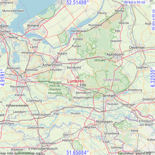
Lunteren GPS coordinates[2]
52° 5' 6" North, 5° 37' 19.992" East
| Map corner | latitude | longitude |
|---|---|---|
| Upper-left | 52.51498°, | 4.9191° |
| Center: | 52.085°, | 5.62222° |
| Lower-right: | 51.65084°, | 6.32535° |
| Map W x H: | 96.1×96.1 km | = 59.7×59.7mi |
| max Lat: | 53.48025° ⇑46.2% North |
| Lunteren: | 52.085° |
| min Lat: | ⇓53.8% South 50.76917° |
| min Long | Lunteren | max Long |
| 3.38611° | 5.62222° | 7.16528° |
| W 48.4%⇐ | ⇒51.6% E |
Elevation
Elevation of Lunteren is 17 m = 56 ft, and this is 2 m = 7 ft above average elevation for this country.
| Max E: |
203 m = 666 ft | 26.5% |
| Lunteren | 17 m 56 ft | |
| Avg. | 15 m = 49 ft | |
Min E: |
-6 m = -20 ft | 73.5% |
See also: Netherlands elevation on elevation.city.
Geographical zone
Lunteren is located in North temperate zone (between Tropic of Cancer and the Arctic Circle). Distance of this North polar circle is 1609.9 km =1000.3 mi to North.| Distance of | km | miles | from Lunteren |
|---|---|---|---|
| North Pole | 4215.8 | 2619.6 | to North |
| Arctic Circle | 1609.9 | 1000.3 | to North |
| Tropic Cancer | 3185.4 | 1979.3 | to South |
| Equator | 5791.3 | 3598.5 | to South |


Nearby cities:
15 places around Lunteren: (largest is in red/bold)
• Barneveld
6.6 km =4.1 mi,  337°
337°
• Bennekom
10.3 km =6.4 mi,  158°
158°
• De Klomp
5.5 km =3.4 mi,  218°
218°
• Doesburg
2.1 km =1.3 mi,  190°
190°
• Ede
6.3 km =3.9 mi, 156°
• Ederveen
3.9 km =2.4 mi,  231°
231°
• Harskamp
10.2 km =6.3 mi,  60°
60°
• Kootwijkerbroek
8 km =5 mi,  23°
23°
• Nederwoud
3.9 km =2.4 mi,  296°
296°
• Overberg
10.1 km =6.3 mi,  240°
240°
• Renswoude
5.7 km =3.5 mi,  256°
256°
• Scherpenzeel
9.1 km =5.7 mi,  266°
266°
• Veenendaal
7.6 km =4.7 mi,  214°
214°
• Wekerom
7 km =4.3 mi, 63°
• Westeneng
7.9 km =4.9 mi,  53°
53°
Sources, notices
• [Note1] Compared only with cities in Netherlands existing in our database
• [Src1] Map data: © OpenStreetMap contributors (CC-BY-SA)
• [Src2] Other city data from geonames.org with taken over terms of usage.
• [Src3] Geographical zone / Annual Mean Temperature by Robert A. Rohde @ Wikipedia
