Kootwijkerbroek geodata
Kootwijkerbroek (Gelderland) is a populated place; located in Netherlands in Europe/Amsterdam (GMT+2) time zone. With population of 1,690 people, there are 1047 cities with bigger population in this country. Compared to other cities in Netherlands, 57% of cities are located further ↓South; 50.6% of cities are located further ←West and 72.5% of cities have lower elevation than Kootwijkerbroek. Note1


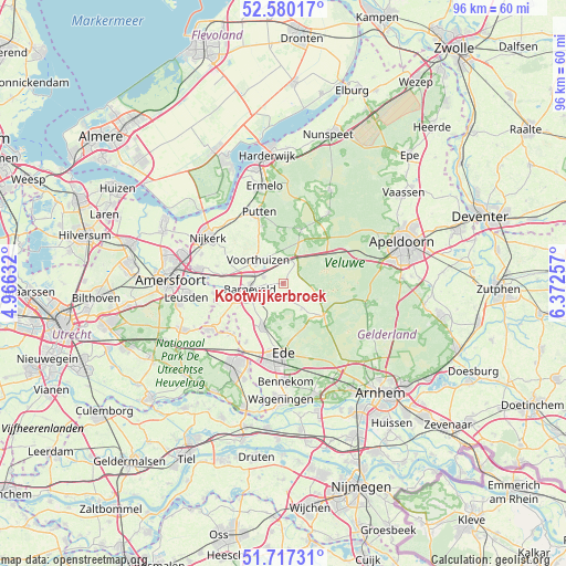
Kootwijkerbroek GPS coordinates[2]
52° 9' 2.988" North, 5° 40' 9.984" East
| Map corner | latitude | longitude |
|---|---|---|
| Upper-left | 52.58017°, | 4.96632° |
| Center: | 52.15083°, | 5.66944° |
| Lower-right: | 51.71731°, | 6.37257° |
| Map W x H: | 95.9×95.9 km | = 59.6×59.6mi |
| max Lat: | 53.48025° ⇑43% North |
| Kootwijkerbroek: | 52.15083° |
| min Lat: | ⇓57% South 50.76917° |
| min Long | Kootwijkerbroek | max Long |
| 3.38611° | 5.66944° | 7.16528° |
| W 50.6%⇐ | ⇒49.4% E |
Elevation
Elevation of Kootwijkerbroek is 16 m = 52 ft, and this is 1 m = 3 ft above average elevation for this country.
| Max E: |
203 m = 666 ft | 27.5% |
| Kootwijkerbroek | 16 m 52 ft | |
| Avg. | 15 m = 49 ft | |
Min E: |
-6 m = -20 ft | 72.5% |
See also: Netherlands elevation on elevation.city.
Geographical zone
Kootwijkerbroek is located in North temperate zone (between Tropic of Cancer and the Arctic Circle). Distance of this North polar circle is 1602.5 km =995.7 mi to North.| Distance of | km | miles | from Kootwijkerbroek |
|---|---|---|---|
| North Pole | 4208.4 | 2615 | to North |
| Arctic Circle | 1602.5 | 995.7 | to North |
| Tropic Cancer | 3192.7 | 1983.9 | to South |
| Equator | 5798.6 | 3603.1 | to South |


Nearby cities:
15 places around Kootwijkerbroek: (largest is in red/bold)
• Appel
9.7 km =6 mi,  294°
294°
• Barneveld
5.9 km =3.7 mi,  258°
258°
• Doesburg
10 km =6.2 mi,  201°
201°
• Ederveen
11.6 km =7.2 mi,  212°
212°
• Garderen
9.4 km =5.8 mi,  18°
18°
• Harskamp
6.1 km =3.8 mi,  112°
112°
• Lunteren
8 km =5 mi, 203°
• Nederwoud
8.7 km =5.4 mi,  230°
230°
• Otterlo
9 km =5.6 mi,  128°
128°
• Stroe
4.2 km =2.6 mi, 21°
• Terschuur
10.5 km =6.5 mi,  278°
278°
• Voorthuizen
5.9 km =3.7 mi,  312°
312°
• Wekerom
5.2 km =3.2 mi,  144°
144°
• Westeneng
4.1 km =2.5 mi, 129°
• Zwartebroek
11.7 km =7.3 mi, 285°
Sources, notices
• [Note1] Compared only with cities in Netherlands existing in our database
• [Src1] Map data: © OpenStreetMap contributors (CC-BY-SA)
• [Src2] Other city data from geonames.org with taken over terms of usage.
• [Src3] Geographical zone / Annual Mean Temperature by Robert A. Rohde @ Wikipedia
