Overberg geodata
Overberg (Utrecht) is a populated place; located in Netherlands in Europe/Amsterdam (GMT+2) time zone. With population of 1,379 people, there are 1193 cities with bigger population in this country. Compared to other cities in Netherlands, 51.3% of cities are located further ↓South; 56.9% of cities are located further →East and 55.1% of cities have lower elevation than Overberg. Note1


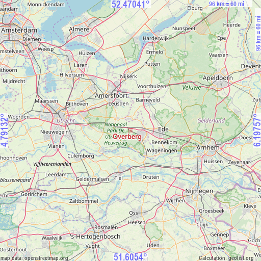
Overberg GPS coordinates[2]
52° 2' 24" North, 5° 29' 39.984" East
| Map corner | latitude | longitude |
|---|---|---|
| Upper-left | 52.47041°, | 4.79132° |
| Center: | 52.04°, | 5.49444° |
| Lower-right: | 51.6054°, | 6.19757° |
| Map W x H: | 96.2×96.2 km | = 59.8×59.8mi |
| max Lat: | 53.48025° ⇑48.7% North |
| Overberg: | 52.04° |
| min Lat: | ⇓51.3% South 50.76917° |
| min Long | Overberg | max Long |
| 3.38611° | 5.49444° | 7.16528° |
| W 43.1%⇐ | ⇒56.9% E |
Elevation
Elevation of Overberg is 8 m = 26 ft, and this is 7 m = 23 ft below average elevation for this country.
| Max E: |
203 m = 666 ft | 44.9% |
| Avg. | 15 m = 49 ft | |
| Overberg | 8 m = 26 ft | |
Min E: |
-6 m = -20 ft | 55.1% |
See also: Netherlands elevation on elevation.city.
Geographical zone
Overberg is located in North temperate zone (between Tropic of Cancer and the Arctic Circle). Distance of this North polar circle is 1614.9 km =1003.5 mi to North.| Distance of | km | miles | from Overberg |
|---|---|---|---|
| North Pole | 4220.8 | 2622.7 | to North |
| Arctic Circle | 1614.9 | 1003.5 | to North |
| Tropic Cancer | 3180.4 | 1976.2 | to South |
| Equator | 5786.3 | 3595.4 | to South |


Nearby cities:
15 places around Overberg: (largest is in red/bold)
• Achterberg
9.8 km =6.1 mi,  139°
139°
• Amerongen
4.8 km =3 mi,  209°
209°
• De Klomp
5.4 km =3.4 mi,  82°
82°
• Doesburg
8.9 km =5.5 mi,  70°
70°
• Eck en Wiel
8.3 km =5.2 mi,  198°
198°
• Ederveen
6.3 km =3.9 mi, 65°
• Ingen
9 km =5.6 mi,  184°
184°
• Leersum
5.5 km =3.4 mi,  235°
235°
• Maarn
8.9 km =5.5 mi,  287°
287°
• Maarsbergen
6.4 km =4 mi, 288°
• Nederwoud
8.5 km =5.3 mi,  37°
37°
• Renswoude
4.9 km =3 mi, 40°
• Scherpenzeel
4.5 km =2.8 mi,  355°
355°
• Veenendaal
4.6 km =2.9 mi,  105°
105°
• Woudenberg
7 km =4.3 mi,  310°
310°
Sources, notices
• [Note1] Compared only with cities in Netherlands existing in our database
• [Src1] Map data: © OpenStreetMap contributors (CC-BY-SA)
• [Src2] Other city data from geonames.org with taken over terms of usage.
• [Src3] Geographical zone / Annual Mean Temperature by Robert A. Rohde @ Wikipedia
