Hoofdplaat geodata
Hoofdplaat (Zeeland) is a populated place; located in Netherlands in Europe/Amsterdam (GMT+2) time zone. With population of 545 people, there are 1784 cities with bigger population in this country. Compared to other cities in Netherlands, 87.2% of cities are located further ↑North; 98.3% of cities are located further →East and 74.9% of cities have higher elevation than Hoofdplaat. Note1


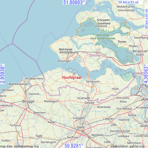
Hoofdplaat GPS coordinates[2]
51° 22' 9.012" North, 3° 39' 45" East
| Map corner | latitude | longitude |
|---|---|---|
| Upper-left | 51.80603°, | 2.95938° |
| Center: | 51.36917°, | 3.6625° |
| Lower-right: | 50.9281°, | 4.36563° |
| Map W x H: | 97.6×97.6 km | = 60.6×60.6mi |
| max Lat: | 53.48025° ⇑87.2% North |
| Hoofdplaat: | 51.36917° |
| min Lat: | ⇓12.8% South 50.76917° |
| min Long | Hoofdplaat | max Long |
| 3.38611° | 3.6625° | 7.16528° |
| W 1.7%⇐ | ⇒98.3% E |
Elevation
Elevation of Hoofdplaat is 2 m = 7 ft, and this is 13 m = 43 ft below average elevation for this country.
| Max E: |
203 m = 666 ft | 74.9% |
| Avg. | 15 m = 49 ft | |
| Hoofdplaat | 2 m = 7 ft | |
Min E: |
-6 m = -20 ft | 25.1% |
See also: Netherlands elevation on elevation.city.
Geographical zone
Hoofdplaat is located in North temperate zone (between Tropic of Cancer and the Arctic Circle). Distance of this North polar circle is 1689.5 km =1049.8 mi to North.| Distance of | km | miles | from Hoofdplaat |
|---|---|---|---|
| North Pole | 4295.3 | 2669 | to North |
| Arctic Circle | 1689.5 | 1049.8 | to North |
| Tropic Cancer | 3105.8 | 1929.9 | to South |
| Equator | 5711.7 | 3549.1 | to South |


Nearby cities:
15 places around Hoofdplaat: (largest is in red/bold)
• Borssele
7.8 km =4.8 mi,  39°
39°
• Breskens
8 km =5 mi,  291°
291°
• Dauwendaele
14 km =8.7 mi,  349°
349°
• Driewegen
11.2 km =7 mi,  60°
60°
• Groede
10.8 km =6.7 mi,  275°
275°
• IJzendijke
6.2 km =3.9 mi,  211°
211°
• Lammerenburg
13 km =8.1 mi,  326°
326°
• Nieuw- en Sint Joosland
12.7 km =7.9 mi,  358°
358°
• Oostburg
13.1 km =8.1 mi,  248°
248°
• Othene
14.3 km =8.9 mi,  107°
107°
• Schoondijke
7.6 km =4.7 mi,  257°
257°
• Terneuzen
12.1 km =7.5 mi, 107°
• Vlissingen
10.2 km =6.3 mi,  322°
322°
• West-Souburg
11.6 km =7.2 mi,  335°
335°
• Westerzicht
11.6 km =7.2 mi, 333°
Sources, notices
• [Note1] Compared only with cities in Netherlands existing in our database
• [Src1] Map data: © OpenStreetMap contributors (CC-BY-SA)
• [Src2] Other city data from geonames.org with taken over terms of usage.
• [Src3] Geographical zone / Annual Mean Temperature by Robert A. Rohde @ Wikipedia
