Heythuysen geodata
Heythuysen (Limburg) is a populated place; located in Netherlands in Europe/Amsterdam (GMT+2) time zone. With population of 6,420 people, there are 387 cities with bigger population in this country. Compared to other cities in Netherlands, 90.4% of cities are located further ↑North; 64.3% of cities are located further ←West and 88.5% of cities have lower elevation than Heythuysen. Note1


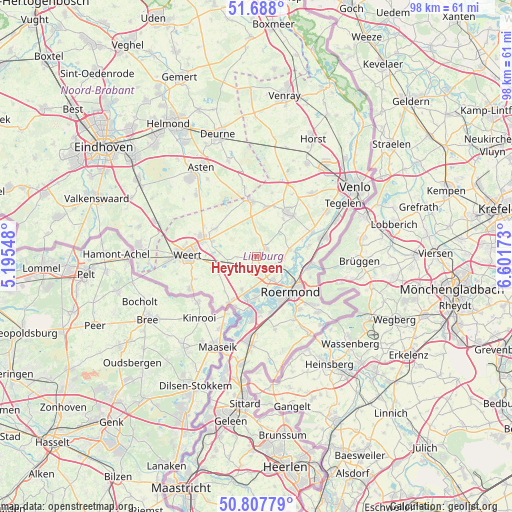
Heythuysen GPS coordinates[2]
51° 15' 0" North, 5° 53' 54.996" East
| Map corner | latitude | longitude |
|---|---|---|
| Upper-left | 51.688°, | 5.19548° |
| Center: | 51.25°, | 5.89861° |
| Lower-right: | 50.80779°, | 6.60173° |
| Map W x H: | 97.9×97.9 km | = 60.8×60.8mi |
| max Lat: | 53.48025° ⇑90.4% North |
| Heythuysen: | 51.25° |
| min Lat: | ⇓9.6% South 50.76917° |
| min Long | Heythuysen | max Long |
| 3.38611° | 5.89861° | 7.16528° |
| W 64.3%⇐ | ⇒35.7% E |
Elevation
Elevation of Heythuysen is 31 m = 102 ft, and this is 16 m = 52 ft above average elevation for this country.
| Max E: |
203 m = 666 ft | 11.5% |
| Heythuysen | 31 m 102 ft | |
| Avg. | 15 m = 49 ft | |
Min E: |
-6 m = -20 ft | 88.5% |
See also: Netherlands elevation on elevation.city.
Geographical zone
Heythuysen is located in North temperate zone (between Tropic of Cancer and the Arctic Circle). Distance of this North polar circle is 1702.7 km =1058 mi to North.| Distance of | km | miles | from Heythuysen |
|---|---|---|---|
| North Pole | 4308.6 | 2677.2 | to North |
| Arctic Circle | 1702.7 | 1058 | to North |
| Tropic Cancer | 3092.5 | 1921.6 | to South |
| Equator | 5698.5 | 3540.9 | to South |


Nearby cities:
15 places around Heythuysen: (largest is in red/bold)
• Beegden
6.9 km =4.3 mi,  167°
167°
• Beesel
10 km =6.2 mi,  78°
78°
• Egchel
8.8 km =5.5 mi,  35°
35°
• Haelen
4.4 km =2.7 mi,  111°
111°
• Heel
7.9 km =4.9 mi,  182°
182°
• Heide
10.1 km =6.3 mi,  95°
95°
• Herten
8.9 km =5.5 mi,  149°
149°
• Kelpen-Oler
6.2 km =3.9 mi,  234°
234°
• Kesseleik
9.2 km =5.7 mi,  70°
70°
• Leeuwen
8.2 km =5.1 mi,  122°
122°
• Leveroy
3.6 km =2.2 mi,  268°
268°
• Merum
9.5 km =5.9 mi, 153°
• Ospel
9.5 km =5.9 mi,  303°
303°
• Roermond
8.8 km =5.5 mi,  135°
135°
• Swartbroek
9 km =5.6 mi,  255°
255°
Sources, notices
• [Note1] Compared only with cities in Netherlands existing in our database
• [Src1] Map data: © OpenStreetMap contributors (CC-BY-SA)
• [Src2] Other city data from geonames.org with taken over terms of usage.
• [Src3] Geographical zone / Annual Mean Temperature by Robert A. Rohde @ Wikipedia
