Helvoirt geodata
Helvoirt (North Brabant) is a populated place; located in Netherlands in Europe/Amsterdam (GMT+2) time zone. With population of 3,625 people, there are 650 cities with bigger population in this country. Compared to other cities in Netherlands, 72.5% of cities are located further ↑North; 65.7% of cities are located further →East and 55.1% of cities have lower elevation than Helvoirt. Note1


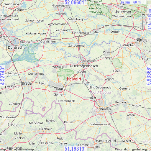
Helvoirt GPS coordinates[2]
51° 37' 54.012" North, 5° 13' 50.016" East
| Map corner | latitude | longitude |
|---|---|---|
| Upper-left | 52.06601°, | 4.52743° |
| Center: | 51.63167°, | 5.23056° |
| Lower-right: | 51.19313°, | 5.93368° |
| Map W x H: | 97.1×97.1 km | = 60.3×60.3mi |
| max Lat: | 53.48025° ⇑72.5% North |
| Helvoirt: | 51.63167° |
| min Lat: | ⇓27.5% South 50.76917° |
| min Long | Helvoirt | max Long |
| 3.38611° | 5.23056° | 7.16528° |
| W 34.3%⇐ | ⇒65.7% E |
Elevation
Elevation of Helvoirt is 8 m = 26 ft, and this is 7 m = 23 ft below average elevation for this country.
| Max E: |
203 m = 666 ft | 44.9% |
| Avg. | 15 m = 49 ft | |
| Helvoirt | 8 m = 26 ft | |
Min E: |
-6 m = -20 ft | 55.1% |
See also: Netherlands elevation on elevation.city.
Geographical zone
Helvoirt is located in North temperate zone (between Tropic of Cancer and the Arctic Circle). Distance of this North polar circle is 1660.3 km =1031.7 mi to North.| Distance of | km | miles | from Helvoirt |
|---|---|---|---|
| North Pole | 4266.2 | 2650.9 | to North |
| Arctic Circle | 1660.3 | 1031.7 | to North |
| Tropic Cancer | 3135 | 1948 | to South |
| Equator | 5740.9 | 3567.2 | to South |


Nearby cities:
15 places around Helvoirt: (largest is in red/bold)
• Biezenmortel
3.7 km =2.3 mi,  257°
257°
• Boxtel
8.2 km =5.1 mi,  123°
123°
• Cromvoirt
3.2 km =2 mi,  1°
1°
• De Kruiskamp
7.8 km =4.8 mi,  15°
15°
• Deuteren
6.6 km =4.1 mi, 22°
• Enschot
8.7 km =5.4 mi,  226°
226°
• Esch
4.7 km =2.9 mi, 119°
• Haaren
3.3 km =2.1 mi,  190°
190°
• Nieuwkuijk
7.3 km =4.5 mi,  332°
332°
• Oisterwijk
6.5 km =4 mi,  206°
206°
• Sint-Michielsgestel
8.5 km =5.3 mi,  82°
82°
• Theereheide
7.4 km =4.6 mi, 84°
• Udenhout
6.5 km =4 mi,  247°
247°
• Vliedberg
7 km =4.3 mi,  336°
336°
• Vught
4.6 km =2.9 mi,  58°
58°
Sources, notices
• [Note1] Compared only with cities in Netherlands existing in our database
• [Src1] Map data: © OpenStreetMap contributors (CC-BY-SA)
• [Src2] Other city data from geonames.org with taken over terms of usage.
• [Src3] Geographical zone / Annual Mean Temperature by Robert A. Rohde @ Wikipedia
