Haren geodata
Haren (Groningen) is a populated place; located in Netherlands in Europe/Amsterdam (GMT+2) time zone. With population of 9,375 people, there are 305 cities with bigger population in this country. Compared to other cities in Netherlands, 91.8% of cities are located further ↓South; 91.5% of cities are located further ←West and 54.1% of cities have higher elevation than Haren. Note1


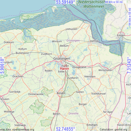
Haren GPS coordinates[2]
53° 10' 19.524" North, 6° 36' 33.516" East
| Map corner | latitude | longitude |
|---|---|---|
| Upper-left | 53.59149°, | 5.90618° |
| Center: | 53.17209°, | 6.60931° |
| Lower-right: | 52.74855°, | 7.31243° |
| Map W x H: | 93.7×93.7 km | = 58.2×58.2mi |
| max Lat: | 53.48025° ⇑8.2% North |
| Haren: | 53.17209° |
| min Lat: | ⇓91.8% South 50.76917° |
| min Long | Haren | max Long |
| 3.38611° | 6.60931° | 7.16528° |
| W 91.5%⇐ | ⇒8.5% E |
Elevation
Elevation of Haren is 5 m = 16 ft, and this is 10 m = 33 ft below average elevation for this country.
| Max E: |
203 m = 666 ft | 54.1% |
| Avg. | 15 m = 49 ft | |
| Haren | 5 m = 16 ft | |
Min E: |
-6 m = -20 ft | 45.9% |
See also: Netherlands elevation on elevation.city.
Geographical zone
Haren is located in North temperate zone (between Tropic of Cancer and the Arctic Circle). Distance of this North polar circle is 1489 km =925.2 mi to North.| Distance of | km | miles | from Haren |
|---|---|---|---|
| North Pole | 4094.9 | 2544.5 | to North |
| Arctic Circle | 1489 | 925.2 | to North |
| Tropic Cancer | 3306.3 | 2054.4 | to South |
| Equator | 5912.2 | 3673.7 | to South |


Nearby cities:
15 places around Haren: (largest is in red/bold)
• Coendersborg
2.8 km =1.7 mi,  331°
331°
• De Wijert
3.6 km =2.2 mi,  314°
314°
• Eelde
5.1 km =3.2 mi,  217°
217°
• Engelbert
4.8 km =3 mi,  32°
32°
• Glimmen
3.9 km =2.4 mi,  160°
160°
• Groningen
6 km =3.7 mi, 331°
• Harkstede
7.5 km =4.7 mi,  52°
52°
• Helpman
3.5 km =2.2 mi, 325°
• Korrewegwijk
7.2 km =4.5 mi,  337°
337°
• Meerwijck
7.4 km =4.6 mi,  112°
112°
• Oosterhoogebrug
6.3 km =3.9 mi,  355°
355°
• Oosterpark
6 km =3.7 mi, 344°
• Paterswolde
4.2 km =2.6 mi, 224°
• Scharmer
7.4 km =4.6 mi,  60°
60°
• Yde
6.3 km =3.9 mi,  189°
189°
Sources, notices
• [Note1] Compared only with cities in Netherlands existing in our database
• [Src1] Map data: © OpenStreetMap contributors (CC-BY-SA)
• [Src2] Other city data from geonames.org with taken over terms of usage.
• [Src3] Geographical zone / Annual Mean Temperature by Robert A. Rohde @ Wikipedia
