Geenhoven geodata
Geenhoven (North Brabant) is a section of populated place; located in Netherlands in Europe/Amsterdam (GMT+2) time zone. With population of 3,270 people, there are 719 cities with bigger population in this country. Compared to other cities in Netherlands, 87.6% of cities are located further ↑North; 58.4% of cities are located further →East and 83.5% of cities have lower elevation than Geenhoven. Note1


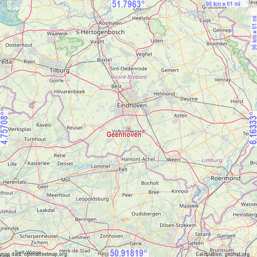
Geenhoven GPS coordinates[2]
51° 21' 33.66" North, 5° 27' 36.756" East
| Map corner | latitude | longitude |
|---|---|---|
| Upper-left | 51.7963°, | 4.75708° |
| Center: | 51.35935°, | 5.46021° |
| Lower-right: | 50.91819°, | 6.16333° |
| Map W x H: | 97.6×97.6 km | = 60.6×60.6mi |
| max Lat: | 53.48025° ⇑87.6% North |
| Geenhoven: | 51.35935° |
| min Lat: | ⇓12.4% South 50.76917° |
| min Long | Geenhoven | max Long |
| 3.38611° | 5.46021° | 7.16528° |
| W 41.6%⇐ | ⇒58.4% E |
Elevation
Elevation of Geenhoven is 25 m = 82 ft, and this is 10 m = 33 ft above average elevation for this country.
| Max E: |
203 m = 666 ft | 16.5% |
| Geenhoven | 25 m 82 ft | |
| Avg. | 15 m = 49 ft | |
Min E: |
-6 m = -20 ft | 83.5% |
See also: Netherlands elevation on elevation.city.
Geographical zone
Geenhoven is located in North temperate zone (between Tropic of Cancer and the Arctic Circle). Distance of this North polar circle is 1690.5 km =1050.4 mi to North.| Distance of | km | miles | from Geenhoven |
|---|---|---|---|
| North Pole | 4296.4 | 2669.7 | to North |
| Arctic Circle | 1690.5 | 1050.4 | to North |
| Tropic Cancer | 3104.7 | 1929.2 | to South |
| Equator | 5710.6 | 3548.4 | to South |


Nearby cities:
15 places around Geenhoven: (largest is in red/bold)
• Aalst
4.3 km =2.7 mi,  16°
16°
• Blaarthem
7.3 km =4.5 mi,  358°
358°
• Borkel
7 km =4.3 mi,  191°
191°
• Dommelen
2.3 km =1.4 mi,  231°
231°
• Ekenrooi
4.5 km =2.8 mi, 23°
• Leende
6.6 km =4.1 mi,  98°
98°
• Meerveldhoven
7.1 km =4.4 mi,  334°
334°
• Ooievaarsnest
6.6 km =4.1 mi,  343°
343°
• Riethoven
5.1 km =3.2 mi,  263°
263°
• Tivoli
7.6 km =4.7 mi,  26°
26°
• Valkenswaard
0.9 km =0.6 mi,  182°
182°
• Voldijn
4.6 km =2.9 mi,  10°
10°
• Waalre
3.2 km =2 mi, 340°
• Westerhoven
5.4 km =3.4 mi,  236°
236°
• Zonderwijk
7.4 km =4.6 mi,  321°
321°
Sources, notices
• [Note1] Compared only with cities in Netherlands existing in our database
• [Src1] Map data: © OpenStreetMap contributors (CC-BY-SA)
• [Src2] Other city data from geonames.org with taken over terms of usage.
• [Src3] Geographical zone / Annual Mean Temperature by Robert A. Rohde @ Wikipedia
