Brakel geodata
Brakel (Gelderland) is a populated place; located in Netherlands in Europe/Amsterdam (GMT+2) time zone. With population of 2,555 people, there are 828 cities with bigger population in this country. Compared to other cities in Netherlands, 63.5% of cities are located further ↑North; 70.4% of cities are located further →East and 65.8% of cities have higher elevation than Brakel. Note1


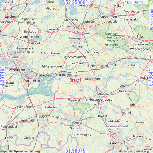
Brakel GPS coordinates[2]
51° 49' 3" North, 5° 5' 25.008" East
| Map corner | latitude | longitude |
|---|---|---|
| Upper-left | 52.25006°, | 4.38716° |
| Center: | 51.8175°, | 5.09028° |
| Lower-right: | 51.38075°, | 5.79341° |
| Map W x H: | 96.7×96.7 km | = 60.1×60.1mi |
| max Lat: | 53.48025° ⇑63.5% North |
| Brakel: | 51.8175° |
| min Lat: | ⇓36.5% South 50.76917° |
| min Long | Brakel | max Long |
| 3.38611° | 5.09028° | 7.16528° |
| W 29.6%⇐ | ⇒70.4% E |
Elevation
Elevation of Brakel is 3 m = 10 ft, and this is 12 m = 39 ft below average elevation for this country.
| Max E: |
203 m = 666 ft | 65.8% |
| Avg. | 15 m = 49 ft | |
| Brakel | 3 m = 10 ft | |
Min E: |
-6 m = -20 ft | 34.2% |
See also: Netherlands elevation on elevation.city.
Geographical zone
Brakel is located in North temperate zone (between Tropic of Cancer and the Arctic Circle). Distance of this North polar circle is 1639.6 km =1018.8 mi to North.| Distance of | km | miles | from Brakel |
|---|---|---|---|
| North Pole | 4245.5 | 2638 | to North |
| Arctic Circle | 1639.6 | 1018.8 | to North |
| Tropic Cancer | 3155.6 | 1960.8 | to South |
| Equator | 5761.6 | 3580.1 | to South |


Nearby cities:
15 places around Brakel: (largest is in red/bold)
• Aalst
4.7 km =2.9 mi,  146°
146°
• Andel
4.4 km =2.7 mi,  210°
210°
• Dalem
5.6 km =3.5 mi,  281°
281°
• Giessen
5.1 km =3.2 mi,  233°
233°
• Hellouw
6 km =3.7 mi,  80°
80°
• Herwijnen
2.9 km =1.8 mi,  69°
69°
• Kedichem
5.5 km =3.4 mi,  329°
329°
• Nieuwaal
6.1 km =3.8 mi,  97°
97°
• Poederoijen
3.5 km =2.2 mi,  191°
191°
• Rijswijk
5 km =3.1 mi,  243°
243°
• Spijk
5.8 km =3.6 mi,  158°
158°
• Veen
4.6 km =2.9 mi, 164°
• Vuren
3.2 km =2 mi,  285°
285°
• Woudrichem
6.1 km =3.8 mi,  267°
267°
• Zuilichem
3.3 km =2.1 mi,  106°
106°
Sources, notices
• [Note1] Compared only with cities in Netherlands existing in our database
• [Src1] Map data: © OpenStreetMap contributors (CC-BY-SA)
• [Src2] Other city data from geonames.org with taken over terms of usage.
• [Src3] Geographical zone / Annual Mean Temperature by Robert A. Rohde @ Wikipedia
