Nieuwaal geodata
Nieuwaal (Gelderland) is a populated place; located in Netherlands in Europe/Amsterdam (GMT+2) time zone. With population of 515 people, there are 1818 cities with bigger population in this country. Compared to other cities in Netherlands, 64.1% of cities are located further ↑North; 67.1% of cities are located further →East and 74.9% of cities have higher elevation than Nieuwaal. Note1


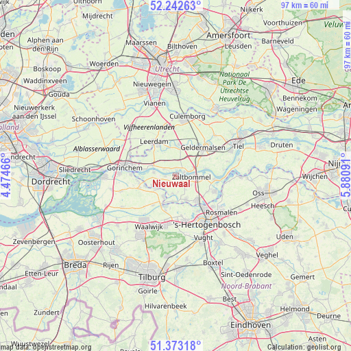
Nieuwaal GPS coordinates[2]
51° 48' 36" North, 5° 10' 40.008" East
| Map corner | latitude | longitude |
|---|---|---|
| Upper-left | 52.24263°, | 4.47466° |
| Center: | 51.81°, | 5.17778° |
| Lower-right: | 51.37318°, | 5.88091° |
| Map W x H: | 96.7×96.7 km | = 60.1×60.1mi |
| max Lat: | 53.48025° ⇑64.1% North |
| Nieuwaal: | 51.81° |
| min Lat: | ⇓35.9% South 50.76917° |
| min Long | Nieuwaal | max Long |
| 3.38611° | 5.17778° | 7.16528° |
| W 32.9%⇐ | ⇒67.1% E |
Elevation
Elevation of Nieuwaal is 2 m = 7 ft, and this is 13 m = 43 ft below average elevation for this country.
| Max E: |
203 m = 666 ft | 74.9% |
| Avg. | 15 m = 49 ft | |
| Nieuwaal | 2 m = 7 ft | |
Min E: |
-6 m = -20 ft | 25.1% |
See also: Netherlands elevation on elevation.city.
Geographical zone
Nieuwaal is located in North temperate zone (between Tropic of Cancer and the Arctic Circle). Distance of this North polar circle is 1640.4 km =1019.3 mi to North.| Distance of | km | miles | from Nieuwaal |
|---|---|---|---|
| North Pole | 4246.3 | 2638.5 | to North |
| Arctic Circle | 1640.4 | 1019.3 | to North |
| Tropic Cancer | 3154.8 | 1960.3 | to South |
| Equator | 5760.7 | 3579.5 | to South |


Nearby cities:
15 places around Nieuwaal: (largest is in red/bold)
• Aalburg
6.9 km =4.3 mi,  207°
207°
• Aalst
4.6 km =2.9 mi,  228°
228°
• Brakel
6.1 km =3.8 mi,  277°
277°
• Bruchem
4.8 km =3 mi,  122°
122°
• Gameren
2.1 km =1.3 mi, 119°
• Haaften
2.4 km =1.5 mi,  74°
74°
• Hellouw
1.9 km =1.2 mi,  357°
357°
• Herwijnen
3.8 km =2.4 mi,  299°
299°
• Nederhemert
5 km =3.1 mi,  187°
187°
• Nederhemert-Noord
5.2 km =3.2 mi,  183°
183°
• Spijk
6 km =3.7 mi,  220°
220°
• Veen
6 km =3.7 mi, 232°
• Waardenburg
6 km =3.7 mi, 65°
• Zaltbommel
4.6 km =2.9 mi,  90°
90°
• Zuilichem
2.9 km =1.8 mi,  268°
268°
Sources, notices
• [Note1] Compared only with cities in Netherlands existing in our database
• [Src1] Map data: © OpenStreetMap contributors (CC-BY-SA)
• [Src2] Other city data from geonames.org with taken over terms of usage.
• [Src3] Geographical zone / Annual Mean Temperature by Robert A. Rohde @ Wikipedia
