Blaricum geodata
Blaricum (North Holland) is a populated place; located in Netherlands in Europe/Amsterdam (GMT+2) time zone. With population of 5,060 people, there are 479 cities with bigger population in this country. Compared to other cities in Netherlands, 65.4% of cities are located further ↓South; 65.4% of cities are located further →East and 52.4% of cities have lower elevation than Blaricum. Note1


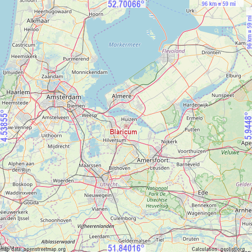
Blaricum GPS coordinates[2]
52° 16' 21" North, 5° 14' 30.012" East
| Map corner | latitude | longitude |
|---|---|---|
| Upper-left | 52.70066°, | 4.53855° |
| Center: | 52.2725°, | 5.24167° |
| Lower-right: | 51.84016°, | 5.9448° |
| Map W x H: | 95.7×95.7 km | = 59.5×59.5mi |
| max Lat: | 53.48025° ⇑34.6% North |
| Blaricum: | 52.2725° |
| min Lat: | ⇓65.4% South 50.76917° |
| min Long | Blaricum | max Long |
| 3.38611° | 5.24167° | 7.16528° |
| W 34.6%⇐ | ⇒65.4% E |
Elevation
Elevation of Blaricum is 7 m = 23 ft, and this is 8 m = 26 ft below average elevation for this country.
| Max E: |
203 m = 666 ft | 47.6% |
| Avg. | 15 m = 49 ft | |
| Blaricum | 7 m = 23 ft | |
Min E: |
-6 m = -20 ft | 52.4% |
See also: Netherlands elevation on elevation.city.
Geographical zone
Blaricum is located in North temperate zone (between Tropic of Cancer and the Arctic Circle). Distance of this North polar circle is 1589 km =987.4 mi to North.| Distance of | km | miles | from Blaricum |
|---|---|---|---|
| North Pole | 4194.9 | 2606.6 | to North |
| Arctic Circle | 1589 | 987.4 | to North |
| Tropic Cancer | 3206.2 | 1992.2 | to South |
| Equator | 5812.2 | 3611.5 | to South |


Nearby cities:
15 places around Blaricum: (largest is in red/bold)
• Ankeveense Rade
9.7 km =6 mi,  260°
260°
• Baarn
7.4 km =4.6 mi,  155°
155°
• Bijvanck
2.2 km =1.4 mi,  47°
47°
• Bunschoten
9.9 km =6.2 mi,  109°
109°
• Bussum
5.5 km =3.4 mi,  270°
270°
• Eemdijk
6.4 km =4 mi, 107°
• Eemnes
2.4 km =1.5 mi,  147°
147°
• Hilversum
7 km =4.3 mi,  219°
219°
• Hilversumse Meent
7.1 km =4.4 mi, 268°
• Huizen
3 km =1.9 mi,  0°
0°
• Kerkelanden
9.5 km =5.9 mi,  229°
229°
• Laren
2 km =1.2 mi,  208°
208°
• Naarden
6 km =3.7 mi,  295°
295°
• Soestdijk
9.5 km =5.9 mi, 162°
• Spakenburg
8.9 km =5.5 mi, 106°
Sources, notices
• [Note1] Compared only with cities in Netherlands existing in our database
• [Src1] Map data: © OpenStreetMap contributors (CC-BY-SA)
• [Src2] Other city data from geonames.org with taken over terms of usage.
• [Src3] Geographical zone / Annual Mean Temperature by Robert A. Rohde @ Wikipedia
