Sandeid geodata
Sandeid (Rogaland) is a populated place; located in Norway in Europe/Oslo (GMT+2) time zone. With population of 534 people, there are 450 cities with bigger population in this country. Compared to other cities in Norway, 77.7% of cities are located further ↑North; 84.3% of cities are located further →East and 84.8% of cities have higher elevation than Sandeid. Note1


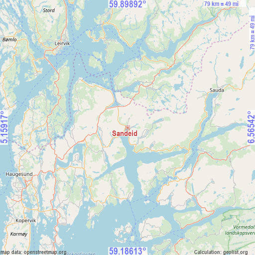
Sandeid GPS coordinates[2]
59° 32' 39.876" North, 5° 51' 44.244" East
| Map corner | latitude | longitude |
|---|---|---|
| Upper-left | 59.89892°, | 5.15917° |
| Center: | 59.54441°, | 5.86229° |
| Lower-right: | 59.18613°, | 6.56542° |
| Map W x H: | 79.3×79.3 km | = 49.3×49.3mi |
| max Lat: | 71.04137° ⇑77.7% North |
| Sandeid: | 59.54441° |
| min Lat: | ⇓22.3% South 58.0274° |
| min Long | Sandeid | max Long |
| 4.71485° | 5.86229° | 31.11066° |
| W 15.7%⇐ | ⇒84.3% E |
Elevation
Elevation of Sandeid is 8 m = 26 ft, and this is 96.2 m = 316 ft below average elevation for this country.
| Max E: |
897 m = 2943 ft | 84.8% |
| Avg. | 104.2 m = 342 ft | |
| Sandeid | 8 m = 26 ft | |
Min E: |
1 m = 3 ft | 15.2% |
See also: Norway elevation on elevation.city.
Geographical zone
Sandeid is located in North temperate zone (between Tropic of Cancer and the Arctic Circle). Distance of this North polar circle is 780.5 km =485 mi to North.| Distance of | km | miles | from Sandeid |
|---|---|---|---|
| North Pole | 3386.3 | 2104.1 | to North |
| Arctic Circle | 780.5 | 485 | to North |
| Tropic Cancer | 4014.8 | 2494.7 | to South |
| Equator | 6620.7 | 4113.9 | to South |


Nearby cities:
15 places around Sandeid: (largest is in red/bold)
• Aksdal
27.1 km =16.8 mi,  240°
240°
• Eike
32.5 km =20.2 mi, 240°
• Etne
14.1 km =8.8 mi,  17°
17°
• Langevåg
36 km =22.4 mi,  281°
281°
• Leirvik
33.1 km =20.6 mi,  322°
322°
• Mosterhamn
31.8 km =19.8 mi,  302°
302°
• Sand
22.9 km =14.2 mi,  106°
106°
• Sauda
30.1 km =18.7 mi,  66°
66°
• Skjold
16.2 km =10.1 mi,  253°
253°
• Skånevik
21.4 km =13.3 mi,  11°
11°
• Sveio
28.8 km =17.9 mi,  269°
269°
• Sæbøvik
29.1 km =18.1 mi,  342°
342°
• Tysvær
31.6 km =19.6 mi,  221°
221°
• Valvatna
35.2 km =21.9 mi,  314°
314°
• Ølen
7.3 km =4.5 mi, 335°
Sources, notices
• [Note1] Compared only with cities in Norway existing in our database
• [Src1] Map data: © OpenStreetMap contributors (CC-BY-SA)
• [Src2] Other city data from geonames.org with taken over terms of usage.
• [Src3] Geographical zone / Annual Mean Temperature by Robert A. Rohde @ Wikipedia
