Ulsteinvik weather pws station geodata
Ulsteinvik weather pws station (Møre og Romsdal) is a populated place; located in Norway in Europe/Oslo (GMT+2) time zone. With population of 5,000 people, there are 93 cities with bigger population in this country. Compared to other cities in Norway, 66.5% of cities are located further ↓South; 85.1% of cities are located further →East and 54.9% of cities have lower elevation than Ulsteinvik weather pws station. Note1
Current local time in Ulsteinvik weather pws station:
08:57 PM, SundayDifference from your time zone: hours


Ulsteinvik weather pws station GPS coordinates[2]
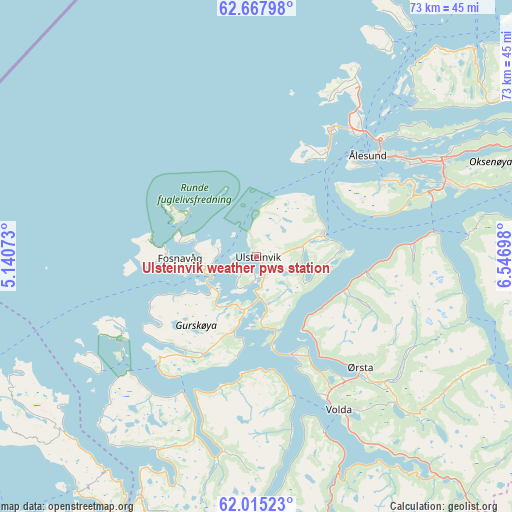
62° 20' 36.168" North, 5° 50' 37.86" East
| Map corner | latitude | longitude |
|---|---|---|
| Upper-left | 62.66798°, | 5.14073° |
| Center: | 62.34338°, | 5.84385° |
| Lower-right: | 62.01523°, | 6.54698° |
| Map W x H: | 72.6×72.6 km | = 45.1×45.1mi |
| max Lat: | 71.04137° ⇑33.5% North |
| Ulsteinvik weather pws station: | 62.34338° |
| min Lat: | ⇓66.5% South 58.0274° |
| min Long | Ulsteinvik weat | max Long |
| 4.71485° | 5.84385° | 31.11066° |
| W 14.9%⇐ | ⇒85.1% E |
Elevation
Elevation of Ulsteinvik weather pws station is 60 m = 197 ft, and this is 44.2 m = 145 ft below average elevation for this country.
| Max E: |
897 m = 2943 ft | 45.1% |
| Avg. | 104.2 m = 342 ft | |
| Ulsteinvik weather pws station | 60 m = 197 ft | |
Min E: |
1 m = 3 ft | 54.9% |
See also: Norway elevation on elevation.city.
Geographical zone
Ulsteinvik weather pws station is located in North temperate zone (between Tropic of Cancer and the Arctic Circle). Distance of this North polar circle is 469.2 km =291.5 mi to North.| Distance of | km | miles | from Ulsteinvik weather pws station |
|---|---|---|---|
| North Pole | 3075.1 | 1910.8 | to North |
| Arctic Circle | 469.2 | 291.5 | to North |
| Tropic Cancer | 4326 | 2688.1 | to South |
| Equator | 6931.9 | 4307.3 | to South |


Nearby cities:
15 places around Ulsteinvik weather pws station: (largest is in red/bold)
• Fiskå
30.8 km =19.1 mi,  208°
208°
• Fosnavåg
10.8 km =6.7 mi,  269°
269°
• Hareid
10 km =6.2 mi,  72°
72°
• Ikornnes
36.8 km =22.9 mi,  82°
82°
• Langevåg
20.9 km =13 mi,  58°
58°
• Larsnes
20.8 km =12.9 mi,  221°
221°
• Nordstranda
24.1 km =15 mi,  38°
38°
• Roald
30.2 km =18.8 mi,  28°
28°
• Sykkylven
38.8 km =24.1 mi, 81°
• Syvik
32.8 km =20.4 mi,  45°
45°
• Ulsteinvik
0.3 km =0.2 mi,  95°
95°
• Valderøy
23 km =14.3 mi, 40°
• Volda
24.9 km =15.5 mi,  151°
151°
• Ålesund
21.5 km =13.4 mi, 48°
• Ørsta
21.7 km =13.5 mi,  137°
137°
Sources, notices
• [Note1] Compared only with cities in Norway existing in our database
• [Src1] Map data: © OpenStreetMap contributors (CC-BY-SA)
• [Src2] Other city data from geonames.org with taken over terms of usage.
• [Src3] Geographical zone / Annual Mean Temperature by Robert A. Rohde @ Wikipedia
