Ørsta geodata
Ørsta (Møre og Romsdal) is a seat of a second-order administrative division; located in Norway in Europe/Oslo (GMT+2) time zone. With population of 6,337 people, there are 70 cities with bigger population in this country. Compared to other cities in Norway, 65.3% of cities are located further ↓South; 81.5% of cities are located further →East and 75.8% of cities have higher elevation than Ørsta. Note1


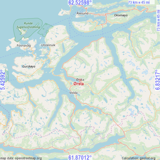
Ørsta GPS coordinates[2]
62° 11' 59.388" North, 6° 7' 44.544" East
| Map corner | latitude | longitude |
|---|---|---|
| Upper-left | 62.52598°, | 5.42592° |
| Center: | 62.19983°, | 6.12904° |
| Lower-right: | 61.87012°, | 6.83217° |
| Map W x H: | 72.9×72.9 km | = 45.3×45.3mi |
| max Lat: | 71.04137° ⇑34.7% North |
| Ørsta: | 62.19983° |
| min Lat: | ⇓65.3% South 58.0274° |
| min Long | Ørsta | max Long |
| 4.71485° | 6.12904° | 31.11066° |
| W 18.5%⇐ | ⇒81.5% E |
Elevation
Elevation of Ørsta is 13 m = 43 ft, and this is 91.2 m = 299 ft below average elevation for this country.
| Max E: |
897 m = 2943 ft | 75.8% |
| Avg. | 104.2 m = 342 ft | |
| Ørsta | 13 m = 43 ft | |
Min E: |
1 m = 3 ft | 24.2% |
See also: Norway elevation on elevation.city.
Geographical zone
Ørsta is located in North temperate zone (between Tropic of Cancer and the Arctic Circle). Distance of this North polar circle is 485.2 km =301.5 mi to North.| Distance of | km | miles | from Ørsta |
|---|---|---|---|
| North Pole | 3091.1 | 1920.7 | to North |
| Arctic Circle | 485.2 | 301.5 | to North |
| Tropic Cancer | 4310.1 | 2678.2 | to South |
| Equator | 6916 | 4297.4 | to South |


Nearby cities:
15 places around Ørsta: (largest is in red/bold)
• Fiskå
31.7 km =19.7 mi,  249°
249°
• Fosnavåg
30.1 km =18.7 mi,  301°
301°
• Hareid
19.7 km =12.2 mi,  344°
344°
• Hornindal
32.9 km =20.4 mi,  141°
141°
• Ikornnes
30.1 km =18.7 mi,  46°
46°
• Langevåg
27 km =16.8 mi,  6°
6°
• Larsnes
28.6 km =17.8 mi,  270°
270°
• Nordfjordeid
32.8 km =20.4 mi,  193°
193°
• Nordstranda
34.9 km =21.7 mi,  0°
0°
• Sykkylven
32.2 km =20 mi, 47°
• Ulsteinvik
21.5 km =13.4 mi,  317°
317°
• Ulsteinvik weather pws station
21.7 km =13.5 mi, 317°
• Valderøy
33.5 km =20.8 mi, 0°
• Volda
6.7 km =4.2 mi,  206°
206°
• Ålesund
30.3 km =18.8 mi, 2°
Sources, notices
• [Note1] Compared only with cities in Norway existing in our database
• [Src1] Map data: © OpenStreetMap contributors (CC-BY-SA)
• [Src2] Other city data from geonames.org with taken over terms of usage.
• [Src3] Geographical zone / Annual Mean Temperature by Robert A. Rohde @ Wikipedia
