Kárášjohka geodata
Kárášjohka (Finnmark) is a seat of a second-order administrative division; located in Norway in Europe/Oslo (GMT+2) time zone. With population of 1,908 people, there are 209 cities with bigger population in this country. Compared to other cities in Norway, 95.9% of cities are located further ↓South; 98.3% of cities are located further ←West and 75.6% of cities have lower elevation than Kárášjohka. Note1


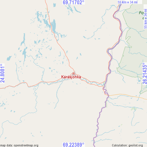
Kárášjohka GPS coordinates[2]
69° 28' 18.732" North, 25° 30' 40.392" East
| Map corner | latitude | longitude |
|---|---|---|
| Upper-left | 69.71702°, | 24.8081° |
| Center: | 69.47187°, | 25.51122° |
| Lower-right: | 69.22389°, | 26.21435° |
| Map W x H: | 54.8×54.8 km | = 34.1×34.1mi |
| max Lat: | 71.04137° ⇑4.1% North |
| Kárášjohka: | 69.47187° |
| min Lat: | ⇓95.9% South 58.0274° |
| min Long | Kárášjohka | max Long |
| 4.71485° | 25.51122° | 31.11066° |
| W 98.3%⇐ | ⇒1.7% E |
Elevation
Elevation of Kárášjohka is 145 m = 476 ft, and this is 40.8 m = 134 ft above average elevation for this country.
| Max E: |
897 m = 2943 ft | 24.4% |
| Kárášjohka | 145 m 476 ft | |
| Avg. | 104.2 m = 342 ft | |
Min E: |
1 m = 3 ft | 75.6% |
See also: Norway elevation on elevation.city.
Geographical zone
Kárášjohka is located in North Frigid zone (between North Pole and Arctic Circle). Distance of this North polar circle is 323.4 km =201 mi to South.| Distance of | km | miles | from Kárášjohka |
|---|---|---|---|
| North Pole | 2282.5 | 1418.3 | to North |
| Arctic Circle | 323.4 | 201 | to South |
| Tropic Cancer | 5118.6 | 3180.5 | to South |
| Equator | 7724.5 | 4799.8 | to South |


Nearby cities:
15 places around Kárášjohka: (largest is in red/bold)
• Alta
102.5 km =63.7 mi,  302°
302°
• Breivikbotn
174.3 km =108.3 mi,  315°
315°
• Burfjord
143.1 km =88.9 mi,  291°
291°
• Hammerfest
149.5 km =92.9 mi,  332°
332°
• Honningsvåg
168.8 km =104.9 mi,  5°
5°
• Kautokeino
109.9 km =68.3 mi,  242°
242°
• Kjøllefjord
177.8 km =110.5 mi,  22°
22°
• Kvalsund
128.6 km =79.9 mi, 333°
• Lakselv
67.7 km =42.1 mi,  342°
342°
• Mehamn
195.4 km =121.4 mi,  26°
26°
• Rypefjord
147.5 km =91.7 mi, 331°
• Tana bru
130.7 km =81.2 mi,  51°
51°
• Vuonnabahta
140.4 km =87.2 mi,  56°
56°
• Ávanuorri
172.5 km =107.2 mi,  349°
349°
• Øksfjord
148.1 km =92 mi,  305°
305°
Sources, notices
• [Note1] Compared only with cities in Norway existing in our database
• [Src1] Map data: © OpenStreetMap contributors (CC-BY-SA)
• [Src2] Other city data from geonames.org with taken over terms of usage.
• [Src3] Geographical zone / Annual Mean Temperature by Robert A. Rohde @ Wikipedia
