Te Kauwhata geodata
Te Kauwhata (Waikato) is a populated place; located in New Zealand in Pacific/Auckland (GMT+12) time zone. With population of 1,174 people, there are 131 cities with bigger population in this country. Compared to other cities in New Zealand, 73.4% of cities are located further ↓South; 69.1% of cities are located further ←West and 64.3% of cities have higher elevation than Te Kauwhata. Note1


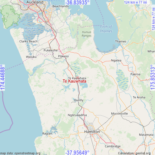
Te Kauwhata GPS coordinates[2]
37° 24' 0" South, 175° 9' 0" East
| Map corner | latitude | longitude |
|---|---|---|
| Upper-left | -36.83935°, | 174.44688° |
| Center: | -37.4°, | 175.15° |
| Lower-right: | -37.95649°, | 175.85313° |
| Map W x H: | 124.2×124.2 km | = 77.2×77.2mi |
| max Lat: | -34.99604° ⇑26.6% North |
| Te Kauwhata: | -37.4° |
| min Lat: | ⇓73.4% South -46.6° |
| min Long | Te Kauwhata | max Long |
| -176.55973° | 175.15° | 178.33333° |
| W 69.1%⇐ | ⇒30.9% E |
Elevation
Elevation of Te Kauwhata is 19 m = 62 ft, and this is 65.4 m = 215 ft below average elevation for this country.
| Max E: |
819 m = 2687 ft | 64.3% |
| Avg. | 84.4 m = 277 ft | |
| Te Kauwhata | 19 m = 62 ft | |
Min E: |
3 m = 10 ft | 35.7% |
See also: New Zealand elevation on elevation.city.
Geographical zone
Te Kauwhata is located in South temperate zone (between Tropic of Capricorn and the Antarctic Circle). Distance of this Southern Tropic circle is 1552.6 km =964.7 mi to North.| Distance of | km | miles | from Te Kauwhata |
|---|---|---|---|
| Equator | 4158.5 | 2584 | to North |
| Tropic Capricorn | 1552.6 | 964.7 | to North |
| Antarctic Circle | 3242.7 | 2014.9 | to South |
| South Pole | 5848.6 | 3634.2 | to South |


Nearby cities:
15 places around Te Kauwhata: (largest is in red/bold)
• Bombay
29.8 km =18.5 mi,  330°
330°
• Hamilton
44.2 km =27.5 mi,  164°
164°
• Kerepehi
35.7 km =22.2 mi,  71°
71°
• Manukau City
51.2 km =31.8 mi, 332°
• Ngaruawahia
29.7 km =18.5 mi,  179°
179°
• Ngatea
33.5 km =20.8 mi, 67°
• Paeroa
45.8 km =28.5 mi,  85°
85°
• Papakura
41.4 km =25.7 mi, 333°
• Pukekohe East
28.4 km =17.6 mi,  321°
321°
• Raglan
50.3 km =31.3 mi,  207°
207°
• Red Hill
41.2 km =25.6 mi,  337°
337°
• Takanini
44.9 km =27.9 mi, 330°
• Thames
45.1 km =28 mi,  49°
49°
• Waiuku
40.4 km =25.1 mi,  294°
294°
• Wiri
51.5 km =32 mi, 330°
Sources, notices
• [Note1] Compared only with cities in New Zealand existing in our database
• [Src1] Map data: © OpenStreetMap contributors (CC-BY-SA)
• [Src2] Other city data from geonames.org with taken over terms of usage.
• [Src3] Geographical zone / Annual Mean Temperature by Robert A. Rohde @ Wikipedia
