Hunterville geodata
Hunterville (Manawatu-Wanganui) is a populated place; located in New Zealand in Pacific/Auckland (GMT+13) time zone. With population of 520 people, there are 198 cities with bigger population in this country. Compared to other cities in New Zealand, 51.2% of cities are located further ↑North; 78.3% of cities are located further ←West and 92.3% of cities have lower elevation than Hunterville. Note1


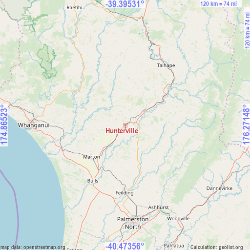
Hunterville GPS coordinates[2]
39° 56' 11.616" South, 175° 34' 6.06" East
| Map corner | latitude | longitude |
|---|---|---|
| Upper-left | -39.39531°, | 174.86523° |
| Center: | -39.93656°, | 175.56835° |
| Lower-right: | -40.47356°, | 176.27148° |
| Map W x H: | 119.9×119.9 km | = 74.5×74.5mi |
| max Lat: | -34.99604° ⇑51.2% North |
| Hunterville: | -39.93656° |
| min Lat: | ⇓48.8% South -46.6° |
| min Long | Hunterville | max Long |
| -176.55973° | 175.56835° | 178.33333° |
| W 78.3%⇐ | ⇒21.7% E |
Elevation
Elevation of Hunterville is 268 m = 879 ft, and this is 183.6 m = 602 ft above average elevation for this country.
| Max E: |
819 m = 2687 ft | 7.7% |
| Hunterville | 268 m 879 ft | |
| Avg. | 84.4 m = 277 ft | |
Min E: |
3 m = 10 ft | 92.3% |
See also: New Zealand elevation on elevation.city.
Geographical zone
Hunterville is located in South temperate zone (between Tropic of Capricorn and the Antarctic Circle). Distance of this Southern Tropic circle is 1834.6 km =1140 mi to North.| Distance of | km | miles | from Hunterville |
|---|---|---|---|
| Equator | 4440.5 | 2759.2 | to North |
| Tropic Capricorn | 1834.6 | 1140 | to North |
| Antarctic Circle | 2960.6 | 1839.6 | to South |
| South Pole | 5566.5 | 3458.9 | to South |


Nearby cities:
15 places around Hunterville: (largest is in red/bold)
• Bulls
30.8 km =19.1 mi,  210°
210°
• Foxton
63.2 km =39.3 mi,  201°
201°
• Himatangi
55.8 km =34.7 mi, 202°
• Levin
81.4 km =50.6 mi, 197°
• Linton Military Camp
51.9 km =32.2 mi,  178°
178°
• Manakau
91.7 km =57 mi, 198°
• Otane
91 km =56.5 mi,  86°
86°
• Palmerston North
46.8 km =29.1 mi, 175°
• Rongotea
41.4 km =25.7 mi, 197°
• Sanson
33.8 km =21 mi, 201°
• Takapau
67.5 km =41.9 mi,  99°
99°
• Tokomaru
59.9 km =37.2 mi, 184°
• Waiouru
51.8 km =32.2 mi,  9°
9°
• Wanganui
44.2 km =27.5 mi,  270°
270°
• Waverley
82 km =51 mi,  283°
283°
Sources, notices
• [Note1] Compared only with cities in New Zealand existing in our database
• [Src1] Map data: © OpenStreetMap contributors (CC-BY-SA)
• [Src2] Other city data from geonames.org with taken over terms of usage.
• [Src3] Geographical zone / Annual Mean Temperature by Robert A. Rohde @ Wikipedia
