Santa Clara geodata
Santa Clara (Panamá Oeste) is a seat of a third-order administrative division; located in Panama in America/Panama (GMT-5) time zone. With population of 1,410 people, there are 168 cities with bigger population in this country. Compared to other cities in Panama, 84.5% of cities are located further ↓South; 81.5% of cities are located further ←West and 56.4% of cities have lower elevation than Santa Clara. Note1


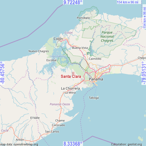
Santa Clara GPS coordinates[2]
9° 1' 43.5" North, 79° 45' 15.948" West
| Map corner | latitude | longitude |
|---|---|---|
| Upper-left | 9.72248°, | -80.45756° |
| Center: | 9.02875°, | -79.75443° |
| Lower-right: | 8.33368°, | -79.05131° |
| Map W x H: | 154.4×154.4 km | = 95.9×95.9mi |
| max Lat: | 9.60898° ⇑15.5% North |
| Santa Clara: | 9.02875° |
| min Lat: | ⇓84.5% South 7.26534° |
| min Long | Santa Clara | max Long |
| -82.91275° | -79.75443° | -77.38965° |
| W 81.5%⇐ | ⇒18.5% E |
Elevation
Elevation of Santa Clara is 92 m = 302 ft, and this is 80.1 m = 263 ft below average elevation for this country.
| Max E: |
2103 m = 6900 ft | 43.6% |
| Avg. | 172.1 m = 565 ft | |
| Santa Clara | 92 m = 302 ft | |
Min E: |
-1 m = -3 ft | 56.4% |
See also: Panama elevation on elevation.city.
Geographical zone
Santa Clara is located in North Torrid zone (between Equator and Tropic of Cancer). Distance of Equator is 1003.9 km =623.8 mi to South.| Distance of | km | miles | from Santa Clara |
|---|---|---|---|
| North Pole | 9003.2 | 5594.3 | to North |
| Arctic Circle | 6397.3 | 3975.1 | to North |
| Tropic Cancer | 1602 | 995.4 | to North |
| Equator | 1003.9 | 623.8 | to South |


Nearby cities:
15 places around Santa Clara: (largest is in red/bold)
• Arraiján
13.4 km =8.3 mi,  129°
129°
• Cerro El Castillo
11.2 km =7 mi, 132°
• Hato Montaña
12.3 km =7.6 mi,  172°
172°
• La Laguna
9.8 km =6.1 mi,  280°
280°
• Mendoza
10.7 km =6.6 mi,  261°
261°
• Monte Claro
14.6 km =9.1 mi,  139°
139°
• Nuevo Arraiján
12.2 km =7.6 mi,  161°
161°
• Nuevo Emperador
3.8 km =2.4 mi, 138°
• Nuevo Guararé
11.4 km =7.1 mi, 158°
• Paraíso
13.9 km =8.6 mi,  87°
87°
• Río Congo
6.9 km =4.3 mi,  186°
186°
• Río Potrero
9.5 km =5.9 mi, 141°
• San José
10.9 km =6.8 mi, 167°
• Vista Alegre
12.6 km =7.8 mi,  153°
153°
• Zangüengas
15.1 km =9.4 mi,  237°
237°
Sources, notices
• [Note1] Compared only with cities in Panama existing in our database
• [Src1] Map data: © OpenStreetMap contributors (CC-BY-SA)
• [Src2] Other city data from geonames.org with taken over terms of usage.
• [Src3] Geographical zone / Annual Mean Temperature by Robert A. Rohde @ Wikipedia
