Quebrada Canoa geodata
Quebrada Canoa (Ngöbe-Buglé) is a populated place; located in Panama in America/Panama (GMT-5) time zone. With population of 3,061 people, there are 94 cities with bigger population in this country. Compared to other cities in Panama, 54.7% of cities are located further ↑North; 74.8% of cities are located further →East and 95% of cities have lower elevation than Quebrada Canoa. Note1


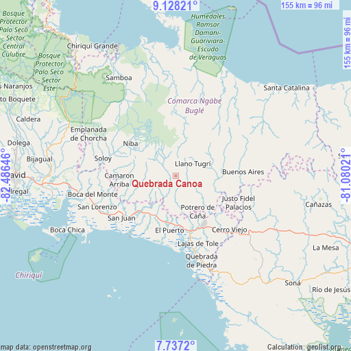
Quebrada Canoa GPS coordinates[2]
8° 25' 59.988" North, 81° 46' 59.988" West
| Map corner | latitude | longitude |
|---|---|---|
| Upper-left | 9.12821°, | -82.48646° |
| Center: | 8.43333°, | -81.78333° |
| Lower-right: | 7.7372°, | -81.08021° |
| Map W x H: | 154.7×154.7 km | = 96.1×96.1mi |
| max Lat: | 9.60898° ⇑54.7% North |
| Quebrada Canoa: | 8.43333° |
| min Lat: | ⇓45.3% South 7.26534° |
| min Long | Quebrada Canoa | max Long |
| -82.91275° | -81.78333° | -77.38965° |
| W 25.2%⇐ | ⇒74.8% E |
Elevation
Elevation of Quebrada Canoa is 669 m = 2195 ft, and this is 496.9 m = 1630 ft above average elevation for this country.
| Max E: |
2103 m = 6900 ft | 5% |
| Quebrada Canoa | 669 m 2195 ft | |
| Avg. | 172.1 m = 565 ft | |
Min E: |
-1 m = -3 ft | 95% |
See also: Panama elevation on elevation.city.
Geographical zone
Quebrada Canoa is located in North Torrid zone (between Equator and Tropic of Cancer). Distance of Equator is 937.7 km =582.7 mi to South.| Distance of | km | miles | from Quebrada Canoa |
|---|---|---|---|
| North Pole | 9069.4 | 5635.5 | to North |
| Arctic Circle | 6463.5 | 4016.2 | to North |
| Tropic Cancer | 1668.2 | 1036.6 | to North |
| Equator | 937.7 | 582.7 | to South |


Nearby cities:
15 places around Quebrada Canoa: (largest is in red/bold)
• Buabidi
10.4 km =6.5 mi,  63°
63°
• Cabecera de Cerro Puerco
13 km =8.1 mi,  168°
168°
• Cerro Ceniza
10.2 km =6.3 mi, 169°
• Cerro Mosquito
14.1 km =8.8 mi,  132°
132°
• Hato Chami
1.6 km =1 mi,  49°
49°
• Hato Culantro
9 km =5.6 mi,  295°
295°
• Hato Jobo
12.2 km =7.6 mi,  247°
247°
• Hato Juli
11.5 km =7.1 mi,  216°
216°
• Hato Pilón
9.8 km =6.1 mi, 246°
• Llano Junco
9.5 km =5.9 mi,  160°
160°
• Maraca
9.1 km =5.7 mi,  137°
137°
• Oma
9.5 km =5.9 mi,  192°
192°
• Peña Blanca
11.9 km =7.4 mi,  74°
74°
• Peña Prieta
10.1 km =6.3 mi, 133°
• Tebujo
8.4 km =5.2 mi, 126°
Sources, notices
• [Note1] Compared only with cities in Panama existing in our database
• [Src1] Map data: © OpenStreetMap contributors (CC-BY-SA)
• [Src2] Other city data from geonames.org with taken over terms of usage.
• [Src3] Geographical zone / Annual Mean Temperature by Robert A. Rohde @ Wikipedia
