Hato Culantro geodata
Hato Culantro (Ngöbe-Buglé) is a seat of a third-order administrative division; located in Panama in America/Panama (GMT-5) time zone. In our database, there are 694 cities with bigger population. Compared to other cities in Panama, 50.3% of cities are located further ↑North; 76.4% of cities are located further →East and 95.3% of cities have lower elevation than Hato Culantro. Note1


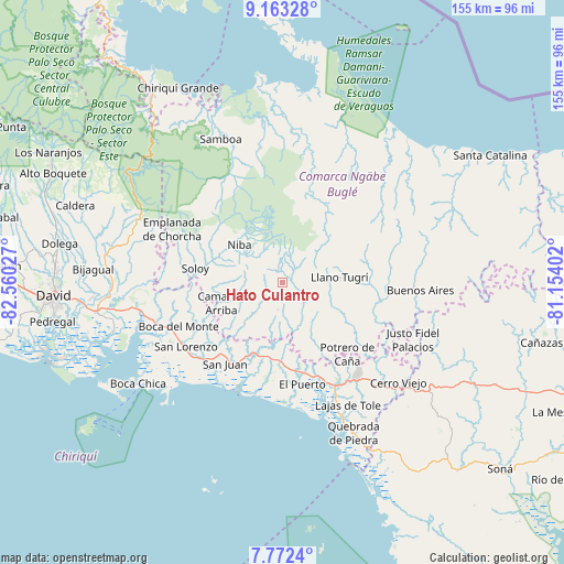
Hato Culantro GPS coordinates[2]
8° 28' 6.492" North, 81° 51' 25.704" West
| Map corner | latitude | longitude |
|---|---|---|
| Upper-left | 9.16328°, | -82.56027° |
| Center: | 8.46847°, | -81.85714° |
| Lower-right: | 7.7724°, | -81.15402° |
| Map W x H: | 154.7×154.7 km | = 96.1×96.1mi |
| max Lat: | 9.60898° ⇑50.3% North |
| Hato Culantro: | 8.46847° |
| min Lat: | ⇓49.7% South 7.26534° |
| min Long | Hato Culantro | max Long |
| -82.91275° | -81.85714° | -77.38965° |
| W 23.6%⇐ | ⇒76.4% E |
Elevation
Elevation of Hato Culantro is 734 m = 2408 ft, and this is 561.9 m = 1844 ft above average elevation for this country.
| Max E: |
2103 m = 6900 ft | 4.7% |
| Hato Culantro | 734 m 2408 ft | |
| Avg. | 172.1 m = 565 ft | |
Min E: |
-1 m = -3 ft | 95.3% |
See also: Panama elevation on elevation.city.
Geographical zone
Hato Culantro is located in North Torrid zone (between Equator and Tropic of Cancer). Distance of Equator is 941.6 km =585.1 mi to South.| Distance of | km | miles | from Hato Culantro |
|---|---|---|---|
| North Pole | 9065.5 | 5633 | to North |
| Arctic Circle | 6459.6 | 4013.8 | to North |
| Tropic Cancer | 1664.3 | 1034.1 | to North |
| Equator | 941.6 | 585.1 | to South |


Nearby cities:
15 places around Hato Culantro: (largest is in red/bold)
• Buabidi
17.5 km =10.9 mi,  87°
87°
• Cascabel
6.7 km =4.2 mi,  344°
344°
• Cerro Ceniza
17.2 km =10.7 mi,  144°
144°
• Hato Chami
9.8 km =6.1 mi,  106°
106°
• Hato Jobo
9.1 km =5.7 mi,  200°
200°
• Hato Juli
13.3 km =8.3 mi,  174°
174°
• Hato Pilón
7.9 km =4.9 mi,  186°
186°
• Llano Junco
17.1 km =10.6 mi, 138°
• Mirones
17.5 km =10.9 mi,  55°
55°
• Oma
14.5 km =9 mi,  155°
155°
• Piedra Roja
16.6 km =10.3 mi,  47°
47°
• Quebrada Canoa
9 km =5.6 mi,  115°
115°
• Quebrada de Loro
14.4 km =8.9 mi,  212°
212°
• Salto Dupí
13.4 km =8.3 mi, 193°
• Tebujo
17.4 km =10.8 mi, 120°
Sources, notices
• [Note1] Compared only with cities in Panama existing in our database
• [Src1] Map data: © OpenStreetMap contributors (CC-BY-SA)
• [Src2] Other city data from geonames.org with taken over terms of usage.
• [Src3] Geographical zone / Annual Mean Temperature by Robert A. Rohde @ Wikipedia
