San Valentín geodata
San Valentín (Chiriquí) is a populated place; located in Panama in America/Panama (GMT-5) time zone. With population of 814 people, there are 316 cities with bigger population in this country. Compared to other cities in Panama, 61% of cities are located further ↑North; 95.8% of cities are located further →East and 92.8% of cities have higher elevation than San Valentín. Note1


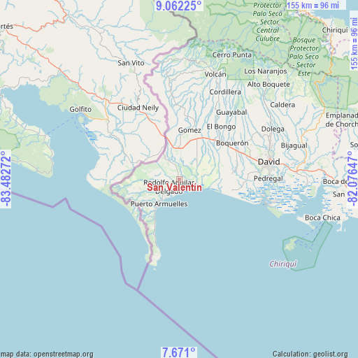
San Valentín GPS coordinates[2]
8° 22' 2.1" North, 82° 46' 46.524" West
| Map corner | latitude | longitude |
|---|---|---|
| Upper-left | 9.06225°, | -83.48272° |
| Center: | 8.36725°, | -82.77959° |
| Lower-right: | 7.671°, | -82.07647° |
| Map W x H: | 154.7×154.7 km | = 96.1×96.1mi |
| max Lat: | 9.60898° ⇑61% North |
| San Valentín: | 8.36725° |
| min Lat: | ⇓39% South 7.26534° |
| min Long | San Valentín | max Long |
| -82.91275° | -82.77959° | -77.38965° |
| W 4.2%⇐ | ⇒95.8% E |
Elevation
Elevation of San Valentín is 10 m = 33 ft, and this is 162.1 m = 532 ft below average elevation for this country.
| Max E: |
2103 m = 6900 ft | 92.8% |
| Avg. | 172.1 m = 565 ft | |
| San Valentín | 10 m = 33 ft | |
Min E: |
-1 m = -3 ft | 7.2% |
See also: Panama elevation on elevation.city.
Geographical zone
San Valentín is located in North Torrid zone (between Equator and Tropic of Cancer). Distance of Equator is 930.4 km =578.1 mi to South.| Distance of | km | miles | from San Valentín |
|---|---|---|---|
| North Pole | 9076.7 | 5640 | to North |
| Arctic Circle | 6470.8 | 4020.8 | to North |
| Tropic Cancer | 1675.6 | 1041.2 | to North |
| Equator | 930.4 | 578.1 | to South |


Nearby cities:
15 places around San Valentín: (largest is in red/bold)
• Agua Buena
12.6 km =7.8 mi,  233°
233°
• Berba
4.2 km =2.6 mi,  298°
298°
• Chuchupate
12 km =7.5 mi,  308°
308°
• Cuervito Abajo
12.8 km =8 mi,  328°
328°
• Divalá
8.7 km =5.4 mi,  56°
56°
• El Palmar
11 km =6.8 mi, 227°
• Finca Blanco
10.5 km =6.5 mi,  277°
277°
• Finca Corredor
10.7 km =6.6 mi,  255°
255°
• La Esperanza
4.2 km =2.6 mi,  341°
341°
• Majagual
3.4 km =2.1 mi,  157°
157°
• Manaca Civil
6.2 km =3.9 mi,  219°
219°
• Manaca Norte
5 km =3.1 mi, 222°
• Progreso
11 km =6.8 mi,  323°
323°
• San Bartolo Línea
12.6 km =7.8 mi,  242°
242°
• Santa María
11.3 km =7 mi, 322°
Sources, notices
• [Note1] Compared only with cities in Panama existing in our database
• [Src1] Map data: © OpenStreetMap contributors (CC-BY-SA)
• [Src2] Other city data from geonames.org with taken over terms of usage.
• [Src3] Geographical zone / Annual Mean Temperature by Robert A. Rohde @ Wikipedia
