Chacas geodata
Chacas (Ancash) is a seat of a third-order administrative division; located in Peru in America/Lima (GMT-5) time zone. In our database, there are 305 cities with bigger population. Compared to other cities in Peru, 66.8% of cities are located further ↓South; 71.1% of cities are located further →East and 91.9% of cities have lower elevation than Chacas. Note1


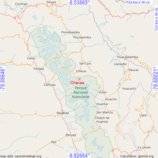
Chacas GPS coordinates[2]
9° 13' 59.988" South, 77° 22' 59.988" West
| Map corner | latitude | longitude |
|---|---|---|
| Upper-left | -8.53865°, | -78.08646° |
| Center: | -9.23333°, | -77.38333° |
| Lower-right: | -9.92664°, | -76.68021° |
| Map W x H: | 154.3×154.3 km | = 95.9×95.9mi |
| max Lat: | -0.96667° ⇑33.2% North |
| Chacas: | -9.23333° |
| min Lat: | ⇓66.8% South -18.01465° |
| min Long | Chacas | max Long |
| -81.30472° | -77.38333° | -69.04167° |
| W 28.9%⇐ | ⇒71.1% E |
Elevation
Elevation of Chacas is 3900 m = 12795 ft, and this is 1581.3 m = 5188 ft above average elevation for this country.
| Max E: |
5022 m = 16476 ft | 8.1% |
| Chacas | 3900 m 12795 ft | |
| Avg. | 2318.7 m = 7607 ft | |
Min E: |
1 m = 3 ft | 91.9% |
See also: Peru elevation on elevation.city.
Geographical zone
Chacas is located in South Torrid zone (between Equator and Tropic of Capricorn). Distance of Equator is 1026.7 km =638 mi to North.| Distance of | km | miles | from Chacas |
|---|---|---|---|
| Equator | 1026.7 | 638 | to North |
| Tropic Capricorn | 1579.3 | 981.3 | to South |
| Antarctic Circle | 6374.5 | 3960.9 | to South |
| South Pole | 8980.4 | 5580.2 | to South |


Nearby cities:
15 places around Chacas: (largest is in red/bold)
• Aco
24.9 km =15.5 mi,  232°
232°
• Acopampa
26.7 km =16.6 mi,  254°
254°
• Amashca
28.9 km =18 mi,  268°
268°
• Anta
27.3 km =17 mi,  239°
239°
• Carhuaz
29.2 km =18.1 mi,  259°
259°
• Huari
19.9 km =12.4 mi,  124°
124°
• Jangas
28.3 km =17.6 mi, 228°
• Marcara District
26.1 km =16.2 mi, 247°
• San Luis
17.1 km =10.6 mi,  12°
12°
• Shilla
26.5 km =16.5 mi, 270°
• Tarica
27.5 km =17.1 mi, 229°
• Tinco
32.7 km =20.3 mi, 262°
• Yanama
24.8 km =15.4 mi,  333°
333°
• Yauya
29.3 km =18.2 mi,  18°
18°
• Yungar
28.1 km =17.5 mi, 235°
Sources, notices
• [Note1] Compared only with cities in Peru existing in our database
• [Src1] Map data: © OpenStreetMap contributors (CC-BY-SA)
• [Src2] Other city data from geonames.org with taken over terms of usage.
• [Src3] Geographical zone / Annual Mean Temperature by Robert A. Rohde @ Wikipedia
