Celendín geodata
Celendín (Cajamarca) is a populated place; located in Peru in America/Lima (GMT-5) time zone. With population of 14,660 people, there are 112 cities with bigger population in this country. Compared to other cities in Peru, 81.1% of cities are located further ↓South; 82.9% of cities are located further →East and 56.2% of cities have higher elevation than Celendín. Note1


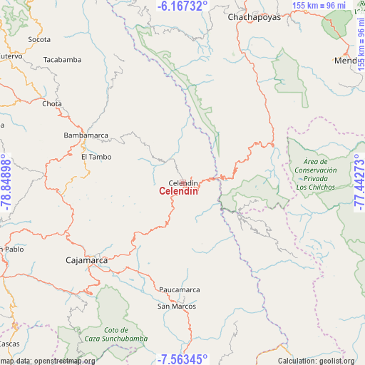
Celendín GPS coordinates[2]
6° 51' 57.24" South, 78° 8' 45.06" West
| Map corner | latitude | longitude |
|---|---|---|
| Upper-left | -6.16732°, | -78.84898° |
| Center: | -6.8659°, | -78.14585° |
| Lower-right: | -7.56345°, | -77.44273° |
| Map W x H: | 155.2×155.2 km | = 96.4×96.4mi |
| max Lat: | -0.96667° ⇑18.9% North |
| Celendín: | -6.8659° |
| min Lat: | ⇓81.1% South -18.01465° |
| min Long | Celendín | max Long |
| -81.30472° | -78.14585° | -69.04167° |
| W 17.1%⇐ | ⇒82.9% E |
Elevation
Elevation of Celendín is 2629 m = 8625 ft, and this is 310.3 m = 1018 ft above average elevation for this country.
| Max E: |
5022 m = 16476 ft | 56.2% |
| Celendín | 2629 m 8625 ft | |
| Avg. | 2318.7 m = 7607 ft | |
Min E: |
1 m = 3 ft | 43.8% |
See also: Peru elevation on elevation.city.
Geographical zone
Celendín is located in South Torrid zone (between Equator and Tropic of Capricorn). Distance of Equator is 763.4 km =474.4 mi to North.| Distance of | km | miles | from Celendín |
|---|---|---|---|
| Equator | 763.4 | 474.4 | to North |
| Tropic Capricorn | 1842.5 | 1144.9 | to South |
| Antarctic Circle | 6637.8 | 4124.5 | to South |
| South Pole | 9243.6 | 5743.7 | to South |


Nearby cities:
15 places around Celendín: (largest is in red/bold)
• Balsas
14.7 km =9.1 mi,  75°
75°
• Chumuch
30.6 km =19 mi,  345°
345°
• Chuquibamba
33.3 km =20.7 mi,  103°
103°
• Cocabamba
32.8 km =20.4 mi,  25°
25°
• Encañada
33 km =20.5 mi,  222°
222°
• Huacapampa
7.6 km =4.7 mi,  169°
169°
• Longotea
33.7 km =20.9 mi,  131°
131°
• Lucmapampa
10.6 km =6.6 mi,  151°
151°
• Montevideo
47 km =29.2 mi,  53°
53°
• Namora
42.5 km =26.4 mi,  209°
209°
• Oxamarca
20.6 km =12.8 mi, 154°
• Sorochuco
13 km =8.1 mi,  247°
247°
• Sucre
7.5 km =4.7 mi,  183°
183°
• Ucuncha
41.5 km =25.8 mi,  135°
135°
• Utco
12 km =7.5 mi,  118°
118°
Sources, notices
• [Note1] Compared only with cities in Peru existing in our database
• [Src1] Map data: © OpenStreetMap contributors (CC-BY-SA)
• [Src2] Other city data from geonames.org with taken over terms of usage.
• [Src3] Geographical zone / Annual Mean Temperature by Robert A. Rohde @ Wikipedia
