Velille geodata
Velille (Cusco) is a seat of a third-order administrative division; located in Peru in America/Lima (GMT-5) time zone. In our database, there are 305 cities with bigger population. Compared to other cities in Peru, 82.6% of cities are located further ↑North; 81.7% of cities are located further ←West and 86.8% of cities have lower elevation than Velille. Note1


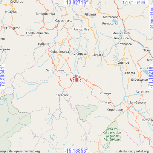
Velille GPS coordinates[2]
14° 30' 32.004" South, 71° 53' 7.008" West
| Map corner | latitude | longitude |
|---|---|---|
| Upper-left | -13.82716°, | -72.58841° |
| Center: | -14.50889°, | -71.88528° |
| Lower-right: | -15.18853°, | -71.18216° |
| Map W x H: | 151.4×151.4 km | = 94.1×94.1mi |
| max Lat: | -0.96667° ⇑82.6% North |
| Velille: | -14.50889° |
| min Lat: | ⇓17.4% South -18.01465° |
| min Long | Velille | max Long |
| -81.30472° | -71.88528° | -69.04167° |
| W 81.7%⇐ | ⇒18.3% E |
Elevation
Elevation of Velille is 3743 m = 12280 ft, and this is 1424.3 m = 4673 ft above average elevation for this country.
| Max E: |
5022 m = 16476 ft | 13.2% |
| Velille | 3743 m 12280 ft | |
| Avg. | 2318.7 m = 7607 ft | |
Min E: |
1 m = 3 ft | 86.8% |
See also: Peru elevation on elevation.city.
Geographical zone
Velille is located in South Torrid zone (between Equator and Tropic of Capricorn). Distance of this Southern Tropic circle is 992.7 km =616.8 mi to South.| Distance of | km | miles | from Velille |
|---|---|---|---|
| Equator | 1613.2 | 1002.4 | to North |
| Tropic Capricorn | 992.7 | 616.8 | to South |
| Antarctic Circle | 5787.9 | 3596.4 | to South |
| South Pole | 8393.8 | 5215.7 | to South |


Nearby cities:
15 places around Velille: (largest is in red/bold)
• Cahuanuyo
49.1 km =30.5 mi,  67°
67°
• Cayarani
23.4 km =14.5 mi,  218°
218°
• Ccaquiracunca
53.5 km =33.2 mi,  61°
61°
• Chamaca
22.8 km =14.2 mi,  11°
11°
• Checca
53.1 km =33 mi,  85°
85°
• Colquemarca
30.3 km =18.8 mi,  326°
326°
• Coporaque
49.9 km =31 mi,  130°
130°
• Haquira
46.5 km =28.9 mi,  315°
315°
• Livitaca
31.4 km =19.5 mi,  42°
42°
• Llusco
31.6 km =19.6 mi,  308°
308°
• Mara
52.9 km =32.9 mi, 332°
• Omacha
51.1 km =31.8 mi,  17°
17°
• Quehue
48.5 km =30.1 mi, 72°
• Quiñota
35.1 km =21.8 mi, 309°
• Santo Tomas
22.5 km =14 mi,  288°
288°
Sources, notices
• [Note1] Compared only with cities in Peru existing in our database
• [Src1] Map data: © OpenStreetMap contributors (CC-BY-SA)
• [Src2] Other city data from geonames.org with taken over terms of usage.
• [Src3] Geographical zone / Annual Mean Temperature by Robert A. Rohde @ Wikipedia
