Pangoa geodata
Pangoa (Cusco) is a populated place; located in Peru in America/Lima (GMT-5) time zone. With population of 6,638 people, there are 197 cities with bigger population in this country. Compared to other cities in Peru, 54.6% of cities are located further ↑North; 73.8% of cities are located further ←West and 75.9% of cities have higher elevation than Pangoa. Note1


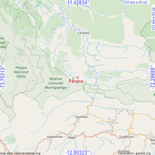
Pangoa GPS coordinates[2]
12° 7' 0.012" South, 73° 0' 0" West
| Map corner | latitude | longitude |
|---|---|---|
| Upper-left | -11.42834°, | -73.70313° |
| Center: | -12.11667°, | -73° |
| Lower-right: | -12.80323°, | -72.29688° |
| Map W x H: | 152.9×152.9 km | = 95×95mi |
| max Lat: | -0.96667° ⇑54.6% North |
| Pangoa: | -12.11667° |
| min Lat: | ⇓45.4% South -18.01465° |
| min Long | Pangoa | max Long |
| -81.30472° | -73° | -69.04167° |
| W 73.8%⇐ | ⇒26.2% E |
Elevation
Elevation of Pangoa is 646 m = 2119 ft, and this is 1672.7 m = 5488 ft below average elevation for this country.
| Max E: |
5022 m = 16476 ft | 75.9% |
| Avg. | 2318.7 m = 7607 ft | |
| Pangoa | 646 m = 2119 ft | |
Min E: |
1 m = 3 ft | 24.1% |
See also: Peru elevation on elevation.city.
Geographical zone
Pangoa is located in South Torrid zone (between Equator and Tropic of Capricorn). Distance of this Southern Tropic circle is 1258.7 km =782.1 mi to South.| Distance of | km | miles | from Pangoa |
|---|---|---|---|
| Equator | 1347.2 | 837.1 | to North |
| Tropic Capricorn | 1258.7 | 782.1 | to South |
| Antarctic Circle | 6053.9 | 3761.7 | to South |
| South Pole | 8659.8 | 5380.9 | to South |


Nearby cities:
15 places around Pangoa: (largest is in red/bold)
• Ayna
115.9 km =72 mi,  239°
239°
• Chungui
139.7 km =86.8 mi,  208°
208°
• Echarate
80.4 km =50 mi,  148°
148°
• Maranura
100.9 km =62.7 mi,  158°
158°
• Ollantaytambo
149.9 km =93.1 mi, 147°
• Pichari
98.4 km =61.1 mi, 244°
• Quebrada Honda
110.2 km =68.5 mi,  130°
130°
• Quellouno
75 km =46.6 mi,  140°
140°
• Quillabamba
89.5 km =55.6 mi, 158°
• San Francisco
103.7 km =64.4 mi, 238°
• San Miguel
145.8 km =90.6 mi,  226°
226°
• Santa Ana
88.9 km =55.2 mi, 159°
• Santa Teresa
121.3 km =75.4 mi, 158°
• Sepahua
108 km =67.1 mi,  357°
357°
• Tambo
142.9 km =88.8 mi, 230°
Sources, notices
• [Note1] Compared only with cities in Peru existing in our database
• [Src1] Map data: © OpenStreetMap contributors (CC-BY-SA)
• [Src2] Other city data from geonames.org with taken over terms of usage.
• [Src3] Geographical zone / Annual Mean Temperature by Robert A. Rohde @ Wikipedia
