Layo geodata
Layo (Cusco) is a seat of a third-order administrative division; located in Peru in America/Lima (GMT-5) time zone. With population of 3,978 people, there are 270 cities with bigger population in this country. Compared to other cities in Peru, 82.4% of cities are located further ↑North; 89.3% of cities are located further ←West and 94.3% of cities have lower elevation than Layo. Note1


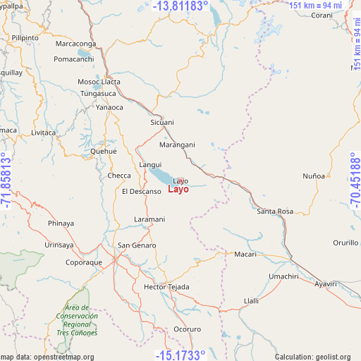
Layo GPS coordinates[2]
14° 29' 36.996" South, 71° 9' 18" West
| Map corner | latitude | longitude |
|---|---|---|
| Upper-left | -13.81183°, | -71.85813° |
| Center: | -14.49361°, | -71.155° |
| Lower-right: | -15.1733°, | -70.45188° |
| Map W x H: | 151.4×151.4 km | = 94.1×94.1mi |
| max Lat: | -0.96667° ⇑82.4% North |
| Layo: | -14.49361° |
| min Lat: | ⇓17.6% South -18.01465° |
| min Long | Layo | max Long |
| -81.30472° | -71.155° | -69.04167° |
| W 89.3%⇐ | ⇒10.7% E |
Elevation
Elevation of Layo is 3985 m = 13074 ft, and this is 1666.3 m = 5467 ft above average elevation for this country.
| Max E: |
5022 m = 16476 ft | 5.7% |
| Layo | 3985 m 13074 ft | |
| Avg. | 2318.7 m = 7607 ft | |
Min E: |
1 m = 3 ft | 94.3% |
See also: Peru elevation on elevation.city.
Geographical zone
Layo is located in South Torrid zone (between Equator and Tropic of Capricorn). Distance of this Southern Tropic circle is 994.4 km =617.9 mi to South.| Distance of | km | miles | from Layo |
|---|---|---|---|
| Equator | 1611.5 | 1001.3 | to North |
| Tropic Capricorn | 994.4 | 617.9 | to South |
| Antarctic Circle | 5789.6 | 3597.5 | to South |
| South Pole | 8395.5 | 5216.7 | to South |


Nearby cities:
15 places around Layo: (largest is in red/bold)
• Accocunca
32.5 km =20.2 mi,  199°
199°
• Cahuanuyo
37.2 km =23.1 mi,  297°
297°
• Callanca
34.8 km =21.6 mi,  2°
2°
• Checca
25.8 km =16 mi,  275°
275°
• Conchopata
5.4 km =3.4 mi, 299°
• El Descanso
16.8 km =10.4 mi,  254°
254°
• Huayna Alcalde
25.7 km =16 mi,  14°
14°
• Langui
14.4 km =8.9 mi, 298°
• Maranganí
15.3 km =9.5 mi,  354°
354°
• Mosoc Cancha
24.3 km =15.1 mi,  17°
17°
• Pichigua
35.1 km =21.8 mi,  233°
233°
• Quehue
34.7 km =21.6 mi,  291°
291°
• San Pablo
36.7 km =22.8 mi,  331°
331°
• San Pedro
39.6 km =24.6 mi, 329°
• Sicuani
26.1 km =16.2 mi,  342°
342°
Sources, notices
• [Note1] Compared only with cities in Peru existing in our database
• [Src1] Map data: © OpenStreetMap contributors (CC-BY-SA)
• [Src2] Other city data from geonames.org with taken over terms of usage.
• [Src3] Geographical zone / Annual Mean Temperature by Robert A. Rohde @ Wikipedia
