Colquepata geodata
Colquepata (Cusco) is a seat of a third-order administrative division; located in Peru in America/Lima (GMT-5) time zone. In our database, there are 305 cities with bigger population. Compared to other cities in Peru, 64.7% of cities are located further ↑North; 83.9% of cities are located further ←West and 83.1% of cities have lower elevation than Colquepata. Note1


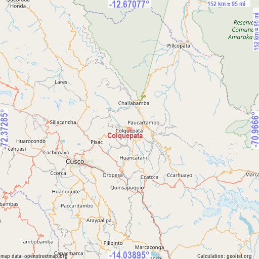
Colquepata GPS coordinates[2]
13° 21' 20.988" South, 71° 40' 10.992" West
| Map corner | latitude | longitude |
|---|---|---|
| Upper-left | -12.67077°, | -72.37285° |
| Center: | -13.35583°, | -71.66972° |
| Lower-right: | -14.03895°, | -70.9666° |
| Map W x H: | 152.1×152.1 km | = 94.5×94.5mi |
| max Lat: | -0.96667° ⇑64.7% North |
| Colquepata: | -13.35583° |
| min Lat: | ⇓35.3% South -18.01465° |
| min Long | Colquepata | max Long |
| -81.30472° | -71.66972° | -69.04167° |
| W 83.9%⇐ | ⇒16.1% E |
Elevation
Elevation of Colquepata is 3592 m = 11785 ft, and this is 1273.3 m = 4177 ft above average elevation for this country.
| Max E: |
5022 m = 16476 ft | 16.9% |
| Colquepata | 3592 m 11785 ft | |
| Avg. | 2318.7 m = 7607 ft | |
Min E: |
1 m = 3 ft | 83.1% |
See also: Peru elevation on elevation.city.
Geographical zone
Colquepata is located in South Torrid zone (between Equator and Tropic of Capricorn). Distance of this Southern Tropic circle is 1120.9 km =696.5 mi to South.| Distance of | km | miles | from Colquepata |
|---|---|---|---|
| Equator | 1485 | 922.7 | to North |
| Tropic Capricorn | 1120.9 | 696.5 | to South |
| Antarctic Circle | 5916.1 | 3676.1 | to South |
| South Pole | 8522 | 5295.3 | to South |


Nearby cities:
15 places around Colquepata: (largest is in red/bold)
• Andahuaylillas
35.2 km =21.9 mi,  181°
181°
• Caicay
26.8 km =16.7 mi,  186°
186°
• Calca
30.4 km =18.9 mi,  274°
274°
• Ccatca
30.1 km =18.7 mi,  156°
156°
• Challabamba
16.9 km =10.5 mi,  5°
5°
• Coya
25.1 km =15.6 mi,  261°
261°
• Lamay
27.5 km =17.1 mi, 268°
• Lucre
32 km =19.9 mi, 193°
• Oropesa
28.6 km =17.8 mi,  202°
202°
• Paucartambo
9.4 km =5.8 mi,  61°
61°
• Pisac
20.5 km =12.7 mi,  248°
248°
• San Salvador
19 km =11.8 mi,  216°
216°
• Saylla
30 km =18.6 mi, 220°
• Taray
22.8 km =14.2 mi, 249°
• Urcos
37.1 km =23.1 mi,  172°
172°
Sources, notices
• [Note1] Compared only with cities in Peru existing in our database
• [Src1] Map data: © OpenStreetMap contributors (CC-BY-SA)
• [Src2] Other city data from geonames.org with taken over terms of usage.
• [Src3] Geographical zone / Annual Mean Temperature by Robert A. Rohde @ Wikipedia
