Acomayo geodata
Acomayo (Cusco) is a seat of a third-order administrative division; located in Peru in America/Lima (GMT-5) time zone. In our database, there are 305 cities with bigger population. Compared to other cities in Peru, 72.6% of cities are located further ↑North; 83.6% of cities are located further ←West and 67.1% of cities have lower elevation than Acomayo. Note1


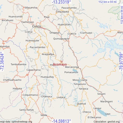
Acomayo GPS coordinates[2]
13° 55' 0.012" South, 71° 40' 51.996" West
| Map corner | latitude | longitude |
|---|---|---|
| Upper-left | -13.23319°, | -72.38424° |
| Center: | -13.91667°, | -71.68111° |
| Lower-right: | -14.59813°, | -70.97799° |
| Map W x H: | 151.8×151.8 km | = 94.3×94.3mi |
| max Lat: | -0.96667° ⇑72.6% North |
| Acomayo: | -13.91667° |
| min Lat: | ⇓27.4% South -18.01465° |
| min Long | Acomayo | max Long |
| -81.30472° | -71.68111° | -69.04167° |
| W 83.6%⇐ | ⇒16.4% E |
Elevation
Elevation of Acomayo is 3290 m = 10794 ft, and this is 971.3 m = 3187 ft above average elevation for this country.
| Max E: |
5022 m = 16476 ft | 32.9% |
| Acomayo | 3290 m 10794 ft | |
| Avg. | 2318.7 m = 7607 ft | |
Min E: |
1 m = 3 ft | 67.1% |
See also: Peru elevation on elevation.city.
Geographical zone
Acomayo is located in South Torrid zone (between Equator and Tropic of Capricorn). Distance of this Southern Tropic circle is 1058.5 km =657.7 mi to South.| Distance of | km | miles | from Acomayo |
|---|---|---|---|
| Equator | 1547.4 | 961.5 | to North |
| Tropic Capricorn | 1058.5 | 657.7 | to South |
| Antarctic Circle | 5853.8 | 3637.4 | to South |
| South Pole | 8459.7 | 5256.6 | to South |


Nearby cities:
15 places around Acomayo: (largest is in red/bold)
• Accha
16.9 km =10.5 mi,  247°
247°
• Acos
7.1 km =4.4 mi,  237°
237°
• Andahuaylillas
27.1 km =16.8 mi,  0°
0°
• Checacupe
27.5 km =17.1 mi,  116°
116°
• Colcha
15 km =9.3 mi,  298°
298°
• Cusipata
19.7 km =12.2 mi,  87°
87°
• Huaro
25.9 km =16.1 mi,  10°
10°
• Lucre
31.8 km =19.8 mi,  348°
348°
• Omacha
18.3 km =11.4 mi,  200°
200°
• Paruro
24.9 km =15.5 mi,  313°
313°
• Pillpinto
9.5 km =5.9 mi, 243°
• Pitumarca
29.9 km =18.6 mi,  101°
101°
• Pomacanchi
17.4 km =10.8 mi,  134°
134°
• Quiquijana
18.5 km =11.5 mi,  55°
55°
• Urcos
26.4 km =16.4 mi, 13°
Sources, notices
• [Note1] Compared only with cities in Peru existing in our database
• [Src1] Map data: © OpenStreetMap contributors (CC-BY-SA)
• [Src2] Other city data from geonames.org with taken over terms of usage.
• [Src3] Geographical zone / Annual Mean Temperature by Robert A. Rohde @ Wikipedia
