Cusipata geodata
Cusipata (Cusco) is a seat of a third-order administrative division; located in Peru in America/Lima (GMT-5) time zone. In our database, there are 305 cities with bigger population. Compared to other cities in Peru, 72.5% of cities are located further ↑North; 85.2% of cities are located further ←West and 68.8% of cities have lower elevation than Cusipata. Note1


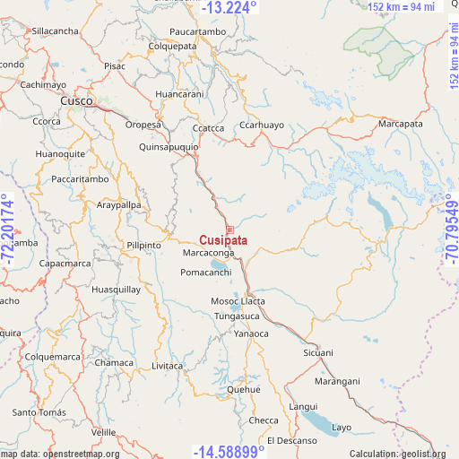
Cusipata GPS coordinates[2]
13° 54' 27" South, 71° 29' 54.996" West
| Map corner | latitude | longitude |
|---|---|---|
| Upper-left | -13.224°, | -72.20174° |
| Center: | -13.9075°, | -71.49861° |
| Lower-right: | -14.58899°, | -70.79549° |
| Map W x H: | 151.8×151.8 km | = 94.3×94.3mi |
| max Lat: | -0.96667° ⇑72.5% North |
| Cusipata: | -13.9075° |
| min Lat: | ⇓27.5% South -18.01465° |
| min Long | Cusipata | max Long |
| -81.30472° | -71.49861° | -69.04167° |
| W 85.2%⇐ | ⇒14.8% E |
Elevation
Elevation of Cusipata is 3323 m = 10902 ft, and this is 1004.3 m = 3295 ft above average elevation for this country.
| Max E: |
5022 m = 16476 ft | 31.2% |
| Cusipata | 3323 m 10902 ft | |
| Avg. | 2318.7 m = 7607 ft | |
Min E: |
1 m = 3 ft | 68.8% |
See also: Peru elevation on elevation.city.
Geographical zone
Cusipata is located in South Torrid zone (between Equator and Tropic of Capricorn). Distance of this Southern Tropic circle is 1059.5 km =658.3 mi to South.| Distance of | km | miles | from Cusipata |
|---|---|---|---|
| Equator | 1546.4 | 960.9 | to North |
| Tropic Capricorn | 1059.5 | 658.3 | to South |
| Antarctic Circle | 5854.8 | 3638 | to South |
| South Pole | 8460.7 | 5257.2 | to South |


Nearby cities:
15 places around Cusipata: (largest is in red/bold)
• Acomayo
19.7 km =12.2 mi,  267°
267°
• Acos
26.2 km =16.3 mi,  259°
259°
• Ccuntuma
26 km =16.2 mi,  158°
158°
• Checacupe
14.2 km =8.8 mi, 159°
• Combapata
22.8 km =14.2 mi, 160°
• Cullcuyre
27.4 km =17 mi,  138°
138°
• Jayobamba
27 km =16.8 mi, 140°
• Lima Pampa
26.8 km =16.7 mi, 139°
• Mosoc Llacta
23.8 km =14.8 mi,  173°
173°
• Pampamarca
26.9 km =16.7 mi, 170°
• Pitumarca
12 km =7.5 mi,  126°
126°
• Pomacanchi
15.2 km =9.4 mi,  209°
209°
• Qquea
20.3 km =12.6 mi, 143°
• Quiquijana
10.4 km =6.5 mi,  334°
334°
• Urcos
28 km =17.4 mi, 331°
Sources, notices
• [Note1] Compared only with cities in Peru existing in our database
• [Src1] Map data: © OpenStreetMap contributors (CC-BY-SA)
• [Src2] Other city data from geonames.org with taken over terms of usage.
• [Src3] Geographical zone / Annual Mean Temperature by Robert A. Rohde @ Wikipedia
