Rikitea geodata
Rikitea (Îles Tuamotu-Gambier) is a populated place; located in French Polynesia in Pacific/Gambier (GMT-9) time zone. With population of 1,103 people, there are 33 cities with bigger population in this country. Compared to other cities in French Polynesia, 97.4% of cities are located further ↑North; 100% of cities are located further ←West and 92.3% of cities have lower elevation than Rikitea. Note1


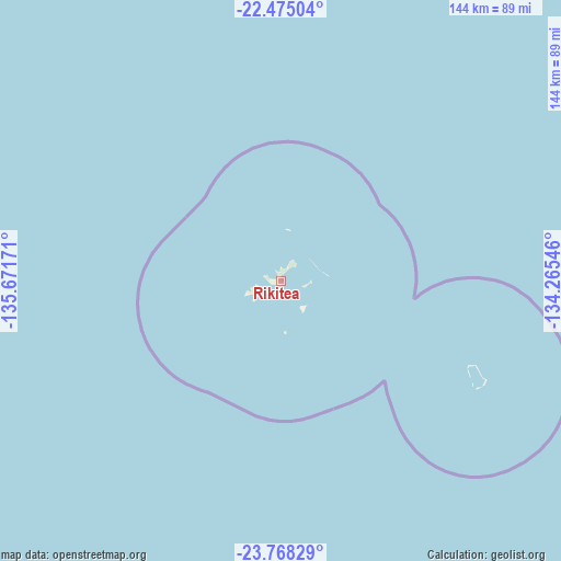
Rikitea GPS coordinates[2]
23° 7' 23.592" South, 134° 58' 6.888" West
| Map corner | latitude | longitude |
|---|---|---|
| Upper-left | -22.47504°, | -135.67171° |
| Center: | -23.12322°, | -134.96858° |
| Lower-right: | -23.76829°, | -134.26546° |
| Map W x H: | 143.8×143.8 km | = 89.4×89.4mi |
| max Lat: | -8.91093° ⇑97.4% North |
| Rikitea: | -23.12322° |
| min Lat: | ⇓2.6% South -23.34722° |
| min Long | Rikitea | max Long |
| -151.74913° | -134.96858° | -134.96858° |
| W 100%⇐ | ⇒0% E |
Elevation
Elevation of Rikitea is 50 m = 164 ft, and this is 27.4 m = 90 ft above average elevation for this country.
| Max E: |
245 m = 804 ft | 7.7% |
| Rikitea | 50 m 164 ft | |
| Avg. | 22.6 m = 74 ft | |
Min E: |
1 m = 3 ft | 92.3% |
See also: French Polynesia elevation on elevation.city.
Geographical zone
Rikitea is located in South Torrid zone (between Equator and Tropic of Capricorn). Distance of this Southern Tropic circle is 34.9 km =21.7 mi to South.| Distance of | km | miles | from Rikitea |
|---|---|---|---|
| Equator | 2571.1 | 1597.6 | to North |
| Tropic Capricorn | 34.9 | 21.7 | to South |
| Antarctic Circle | 4830.1 | 3001.3 | to South |
| South Pole | 7436 | 4620.5 | to South |


Nearby cities:
15 places around Rikitea: (largest is in red/bold)
• Afaahiti
1609.8 km =1000.3 mi,  291°
291°
• Atuona
1543.1 km =958.8 mi,  343°
343°
• Faone
1611.7 km =1001.5 mi, 292°
• Hitiaa
1614 km =1002.9 mi, 292°
• Mahaena
1617.2 km =1004.9 mi, 292°
• Mataura
1482.7 km =921.3 mi,  269°
269°
• Otutara
1617.1 km =1004.8 mi, 291°
• Pueu
1600.3 km =994.4 mi, 291°
• Tapuarava
540.6 km =335.9 mi, 343°
• Taunoa
1612.5 km =1002 mi, 291°
• Tautira
1593.9 km =990.4 mi, 292°
• Teahupoo
1599.6 km =993.9 mi, 291°
• Tiarei
1620.4 km =1006.9 mi, 292°
• Tohautu
1608.2 km =999.3 mi, 291°
• Vairao
1604 km =996.7 mi, 291°
Sources, notices
• [Note1] Compared only with cities in French Polynesia existing in our database
• [Src1] Map data: © OpenStreetMap contributors (CC-BY-SA)
• [Src2] Other city data from geonames.org with taken over terms of usage.
• [Src3] Geographical zone / Annual Mean Temperature by Robert A. Rohde @ Wikipedia
