Tapuarava geodata
Tapuarava (Îles Tuamotu-Gambier) is a seat of a second-order administrative division; located in French Polynesia in Pacific/Tahiti (GMT-10) time zone. In our database, there are 39 cities with bigger population. Compared to other cities in French Polynesia, 89.7% of cities are located further ↑North; 97.4% of cities are located further ←West and 87.2% of cities have higher elevation than Tapuarava. Note1


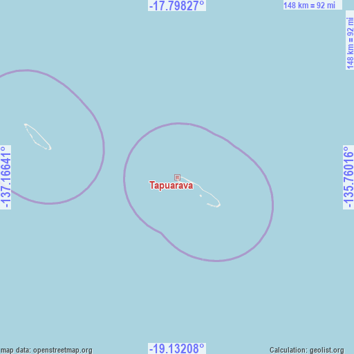
Tapuarava GPS coordinates[2]
18° 27' 59.292" South, 136° 27' 47.808" West
| Map corner | latitude | longitude |
|---|---|---|
| Upper-left | -17.79827°, | -137.16641° |
| Center: | -18.46647°, | -136.46328° |
| Lower-right: | -19.13208°, | -135.76016° |
| Map W x H: | 148.3×148.3 km | = 92.1×92.1mi |
| max Lat: | -8.91093° ⇑89.7% North |
| Tapuarava: | -18.46647° |
| min Lat: | ⇓10.3% South -23.34722° |
| min Long | Tapuarava | max Long |
| -151.74913° | -136.46328° | -134.96858° |
| W 97.4%⇐ | ⇒2.6% E |
Elevation
Elevation of Tapuarava is 3 m = 10 ft, and this is 19.6 m = 64 ft below average elevation for this country.
| Max E: |
245 m = 804 ft | 87.2% |
| Avg. | 22.6 m = 74 ft | |
| Tapuarava | 3 m = 10 ft | |
Min E: |
1 m = 3 ft | 12.8% |
See also: French Polynesia elevation on elevation.city.
Geographical zone
Tapuarava is located in South Torrid zone (between Equator and Tropic of Capricorn). Distance of this Southern Tropic circle is 552.6 km =343.4 mi to South.| Distance of | km | miles | from Tapuarava |
|---|---|---|---|
| Equator | 2053.3 | 1275.9 | to North |
| Tropic Capricorn | 552.6 | 343.4 | to South |
| Antarctic Circle | 5347.9 | 3323 | to South |
| South Pole | 7953.8 | 4942.3 | to South |


Nearby cities:
15 places around Tapuarava: (largest is in red/bold)
• Afaahiti
1361.3 km =845.9 mi,  273°
273°
• Atuona
1002.5 km =622.9 mi,  343°
343°
• Faone
1360.5 km =845.4 mi, 273°
• Hitiaa
1360.3 km =845.3 mi, 274°
• Mahaena
1362.5 km =846.6 mi, 274°
• Otutara
1370.4 km =851.5 mi, 273°
• Pueu
1350.8 km =839.3 mi, 273°
• Rikitea
540.6 km =335.9 mi,  163°
163°
• Taiohae
1132.6 km =703.8 mi, 339°
• Taunoa
1364.6 km =847.9 mi, 273°
• Tautira
1344.1 km =835.2 mi, 273°
• Teahupoo
1354.2 km =841.5 mi, 272°
• Tiarei
1364.6 km =847.9 mi, 274°
• Tohautu
1360.3 km =845.3 mi, 273°
• Vairao
1356.6 km =843 mi, 273°
Sources, notices
• [Note1] Compared only with cities in French Polynesia existing in our database
• [Src1] Map data: © OpenStreetMap contributors (CC-BY-SA)
• [Src2] Other city data from geonames.org with taken over terms of usage.
• [Src3] Geographical zone / Annual Mean Temperature by Robert A. Rohde @ Wikipedia
