Vizal San Pablo geodata
Vizal San Pablo (Central Luzon) is a populated place; located in Philippines in Asia/Manila (GMT+8) time zone. With population of 2,322 people, there are 3632 cities with bigger population in this country. Compared to other cities in Philippines, 78.3% of cities are located further ↓South; 79.4% of cities are located further →East and 70.2% of cities have higher elevation than Vizal San Pablo. Note1


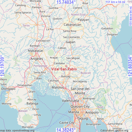
Vizal San Pablo GPS coordinates[2]
15° 3' 44.892" North, 120° 54' 0.756" East
| Map corner | latitude | longitude |
|---|---|---|
| Upper-left | 15.74034°, | 120.19709° |
| Center: | 15.06247°, | 120.90021° |
| Lower-right: | 14.38243°, | 121.60334° |
| Map W x H: | 151×151 km | = 93.8×93.8mi |
| max Lat: | 20.78733° ⇑21.7% North |
| Vizal San Pablo: | 15.06247° |
| min Lat: | ⇓78.3% South 4.65442° |
| min Long | Vizal San Pablo | max Long |
| 117.04868° | 120.90021° | 126.58417° |
| W 20.6%⇐ | ⇒79.4% E |
Elevation
Elevation of Vizal San Pablo is 12 m = 39 ft, and this is 75.9 m = 249 ft below average elevation for this country.
| Max E: |
2262 m = 7421 ft | 70.2% |
| Avg. | 87.9 m = 288 ft | |
| Vizal San Pablo | 12 m = 39 ft | |
Min E: |
-2 m = -7 ft | 29.8% |
See also: Philippines elevation on elevation.city.
Geographical zone
Vizal San Pablo is located in North Torrid zone (between Equator and Tropic of Cancer). Distance of this Northern Tropic circle is 931.1 km =578.6 mi to North.| Distance of | km | miles | from Vizal San Pablo |
|---|---|---|---|
| North Pole | 8332.3 | 5177.4 | to North |
| Arctic Circle | 5726.4 | 3558.2 | to North |
| Tropic Cancer | 931.1 | 578.6 | to North |
| Equator | 1674.8 | 1040.7 | to South |


Nearby cities:
15 places around Vizal San Pablo: (largest is in red/bold)
• Bahay Pare
3.9 km =2.4 mi,  211°
211°
• Batasan Bata
10.1 km =6.3 mi,  25°
25°
• Candaba
8.7 km =5.4 mi,  295°
295°
• Diliman Primero
7 km =4.3 mi,  127°
127°
• Lourdes
7.1 km =4.4 mi,  227°
227°
• Maguinao
5.8 km =3.6 mi,  140°
140°
• Mapaniqui
5.5 km =3.4 mi, 26°
• Salapungan
8.5 km =5.3 mi,  20°
20°
• San Ildefonso
4.8 km =3 mi,  64°
64°
• San Isidro
9.7 km =6 mi,  241°
241°
• San Roque
7.2 km =4.5 mi,  145°
145°
• Santo Tomas
11.2 km =7 mi,  253°
253°
• Talang
7.9 km =4.9 mi, 238°
• Upig
10.7 km =6.6 mi,  112°
112°
• Vizal Santo Niño
3.7 km =2.3 mi,  171°
171°
Sources, notices
• [Note1] Compared only with cities in Philippines existing in our database
• [Src1] Map data: © OpenStreetMap contributors (CC-BY-SA)
• [Src2] Other city data from geonames.org with taken over terms of usage.
• [Src3] Geographical zone / Annual Mean Temperature by Robert A. Rohde @ Wikipedia
