San Ildefonso geodata
San Ildefonso (Central Luzon) is a seat of a third-order administrative division; located in Philippines in Asia/Manila (GMT+8) time zone. With population of 65,669 people, there are 143 cities with bigger population in this country. Compared to other cities in Philippines, 78.4% of cities are located further ↓South; 77.9% of cities are located further →East and 51.8% of cities have higher elevation than San Ildefonso. Note1
Administrative division(s):
- Level 1: Central Luzon
- Level 2: Province of Bulacan
- Level 3: San Ildefonso


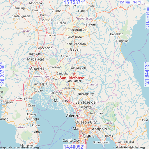
San Ildefonso GPS coordinates[2]
15° 4' 51.24" North, 120° 56' 27.6" East
| Map corner | latitude | longitude |
|---|---|---|
| Upper-left | 15.75871°, | 120.23788° |
| Center: | 15.0809°, | 120.941° |
| Lower-right: | 14.40092°, | 121.64413° |
| Map W x H: | 151×151 km | = 93.8×93.8mi |
| max Lat: | 20.78733° ⇑21.6% North |
| San Ildefonso: | 15.0809° |
| min Lat: | ⇓78.4% South 4.65442° |
| min Long | San Ildefonso | max Long |
| 117.04868° | 120.941° | 126.58417° |
| W 22.1%⇐ | ⇒77.9% E |
Elevation
Elevation of San Ildefonso is 22 m = 72 ft, and this is 65.9 m = 216 ft below average elevation for this country.
| Max E: |
2262 m = 7421 ft | 51.8% |
| Avg. | 87.9 m = 288 ft | |
| San Ildefonso | 22 m = 72 ft | |
Min E: |
-2 m = -7 ft | 48.2% |
See also: San Ildefonso elevation on elevation.city.
Geographical zone
San Ildefonso is located in North Torrid zone (between Equator and Tropic of Cancer). Distance of this Northern Tropic circle is 929.1 km =577.3 mi to North.| Distance of | km | miles | from San Ildefonso |
|---|---|---|---|
| North Pole | 8330.2 | 5176.1 | to North |
| Arctic Circle | 5724.3 | 3556.9 | to North |
| Tropic Cancer | 929.1 | 577.3 | to North |
| Equator | 1676.8 | 1041.9 | to South |


Nearby cities:
15 places around San Ildefonso: (largest is in red/bold)
• Bahay Pare
8.4 km =5.2 mi,  230°
230°
• Batasan Bata
7.1 km =4.4 mi,  359°
359°
• Camias
10.2 km =6.3 mi,  20°
20°
• Candaba
12.4 km =7.7 mi,  277°
277°
• Diliman Primero
6.4 km =4 mi,  169°
169°
• Lourdes
11.8 km =7.3 mi, 234°
• Maguinao
6.6 km =4.1 mi,  186°
186°
• Mapaniqui
3.5 km =2.2 mi,  326°
326°
• Salapungan
6.1 km =3.8 mi,  346°
346°
• San Miguel
7.8 km =4.8 mi,  28°
28°
• San Roque
7.9 km =4.9 mi,  182°
182°
• Tartaro
12.5 km =7.8 mi,  40°
40°
• Upig
8.2 km =5.1 mi,  138°
138°
• Vizal San Pablo
4.8 km =3 mi,  244°
244°
• Vizal Santo Niño
6.9 km =4.3 mi,  213°
213°
Sources, notices
• [Note1] Compared only with cities in Philippines existing in our database
• [Src1] Map data: © OpenStreetMap contributors (CC-BY-SA)
• [Src2] Other city data from geonames.org with taken over terms of usage.
• [Src3] Geographical zone / Annual Mean Temperature by Robert A. Rohde @ Wikipedia
