Unisan geodata
Unisan (Calabarzon) is a populated place; located in Philippines in Asia/Manila (GMT+8) time zone. With population of 4,764 people, there are 1390 cities with bigger population in this country. Compared to other cities in Philippines, 66.2% of cities are located further ↓South; 60.5% of cities are located further →East and 97.1% of cities have higher elevation than Unisan. Note1


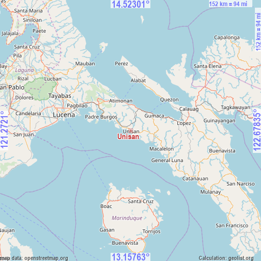
Unisan GPS coordinates[2]
13° 50' 28.752" North, 121° 58' 30.792" East
| Map corner | latitude | longitude |
|---|---|---|
| Upper-left | 14.52301°, | 121.2721° |
| Center: | 13.84132°, | 121.97522° |
| Lower-right: | 13.15763°, | 122.67835° |
| Map W x H: | 151.8×151.8 km | = 94.3×94.3mi |
| max Lat: | 20.78733° ⇑33.8% North |
| Unisan: | 13.84132° |
| min Lat: | ⇓66.2% South 4.65442° |
| min Long | Unisan | max Long |
| 117.04868° | 121.97522° | 126.58417° |
| W 39.5%⇐ | ⇒60.5% E |
Elevation
Elevation of Unisan is 4 m = 13 ft, and this is 83.9 m = 275 ft below average elevation for this country.
| Max E: |
2262 m = 7421 ft | 97.1% |
| Avg. | 87.9 m = 288 ft | |
| Unisan | 4 m = 13 ft | |
Min E: |
-2 m = -7 ft | 2.9% |
See also: Philippines elevation on elevation.city.
Geographical zone
Unisan is located in North Torrid zone (between Equator and Tropic of Cancer). Distance of this Northern Tropic circle is 1066.9 km =662.9 mi to North.| Distance of | km | miles | from Unisan |
|---|---|---|---|
| North Pole | 8468.1 | 5261.8 | to North |
| Arctic Circle | 5862.2 | 3642.6 | to North |
| Tropic Cancer | 1066.9 | 662.9 | to North |
| Equator | 1539 | 956.3 | to South |


Nearby cities:
15 places around Unisan: (largest is in red/bold)
• Agdangan
7.8 km =4.8 mi,  300°
300°
• Atimonan
18.9 km =11.7 mi,  341°
341°
• Calilayan
5 km =3.1 mi,  281°
281°
• Camohaguin
22 km =13.7 mi,  70°
70°
• Gumaca
16.1 km =10 mi,  56°
56°
• Mabunga
10.3 km =6.4 mi,  76°
76°
• Macalelon
20.5 km =12.7 mi,  120°
120°
• Malicboy
25.4 km =15.8 mi,  307°
307°
• Malinao Ilaya
22.9 km =14.2 mi,  318°
318°
• Marao
18.2 km =11.3 mi, 296°
• Padre Burgos
19.8 km =12.3 mi, 297°
• Panikihan
18.4 km =11.4 mi, 66°
• Pitogo
14 km =8.7 mi, 117°
• Plaridel
13.6 km =8.5 mi,  21°
21°
• Progreso
14.5 km =9 mi, 59°
Sources, notices
• [Note1] Compared only with cities in Philippines existing in our database
• [Src1] Map data: © OpenStreetMap contributors (CC-BY-SA)
• [Src2] Other city data from geonames.org with taken over terms of usage.
• [Src3] Geographical zone / Annual Mean Temperature by Robert A. Rohde @ Wikipedia
