Agdangan geodata
Agdangan (Calabarzon) is a seat of a third-order administrative division; located in Philippines in Asia/Manila (GMT+8) time zone. With population of 3,918 people, there are 1777 cities with bigger population in this country. Compared to other cities in Philippines, 67% of cities are located further ↓South; 61.4% of cities are located further →East and 76.6% of cities have higher elevation than Agdangan. Note1


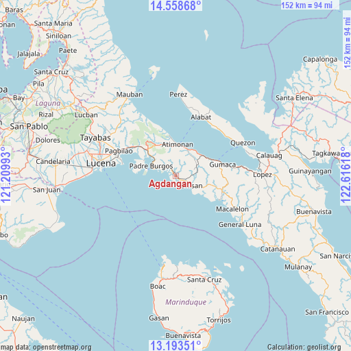
Agdangan GPS coordinates[2]
13° 52' 37.56" North, 121° 54' 46.98" East
| Map corner | latitude | longitude |
|---|---|---|
| Upper-left | 14.55868°, | 121.20993° |
| Center: | 13.8771°, | 121.91305° |
| Lower-right: | 13.19351°, | 122.61618° |
| Map W x H: | 151.8×151.8 km | = 94.3×94.3mi |
| max Lat: | 20.78733° ⇑33% North |
| Agdangan: | 13.8771° |
| min Lat: | ⇓67% South 4.65442° |
| min Long | Agdangan | max Long |
| 117.04868° | 121.91305° | 126.58417° |
| W 38.6%⇐ | ⇒61.4% E |
Elevation
Elevation of Agdangan is 10 m = 33 ft, and this is 77.9 m = 256 ft below average elevation for this country.
| Max E: |
2262 m = 7421 ft | 76.6% |
| Avg. | 87.9 m = 288 ft | |
| Agdangan | 10 m = 33 ft | |
Min E: |
-2 m = -7 ft | 23.4% |
See also: Philippines elevation on elevation.city.
Geographical zone
Agdangan is located in North Torrid zone (between Equator and Tropic of Cancer). Distance of this Northern Tropic circle is 1062.9 km =660.5 mi to North.| Distance of | km | miles | from Agdangan |
|---|---|---|---|
| North Pole | 8464.1 | 5259.3 | to North |
| Arctic Circle | 5858.2 | 3640.1 | to North |
| Tropic Cancer | 1062.9 | 660.5 | to North |
| Equator | 1543 | 958.8 | to South |


Nearby cities:
15 places around Agdangan: (largest is in red/bold)
• Atimonan
14 km =8.7 mi,  3°
3°
• Binahaan
21.4 km =13.3 mi,  306°
306°
• Calilayan
3.5 km =2.2 mi,  148°
148°
• Gumaca
20.8 km =12.9 mi,  76°
76°
• Mabunga
16.8 km =10.4 mi,  95°
95°
• Malicboy
17.7 km =11 mi, 310°
• Malinao Ilaya
15.6 km =9.7 mi,  327°
327°
• Marao
10.5 km =6.5 mi,  293°
293°
• Padre Burgos
12.1 km =7.5 mi, 294°
• Pagbilao
25.2 km =15.7 mi, 293°
• Panikihan
23.8 km =14.8 mi, 81°
• Pitogo
21.8 km =13.5 mi,  118°
118°
• Plaridel
14.5 km =9 mi,  53°
53°
• Progreso
19.5 km =12.1 mi, 79°
• Unisan
7.8 km =4.8 mi, 120°
Sources, notices
• [Note1] Compared only with cities in Philippines existing in our database
• [Src1] Map data: © OpenStreetMap contributors (CC-BY-SA)
• [Src2] Other city data from geonames.org with taken over terms of usage.
• [Src3] Geographical zone / Annual Mean Temperature by Robert A. Rohde @ Wikipedia
