Tuburan geodata
Tuburan (Central Visayas) is a seat of a third-order administrative division; located in Philippines in Asia/Manila (GMT+8) time zone. In our database, there are 4166 cities with bigger population. Compared to other cities in Philippines, 60.5% of cities are located further ↑North; 68.2% of cities are located further ←West and 100% of cities have higher elevation than Tuburan. Note1


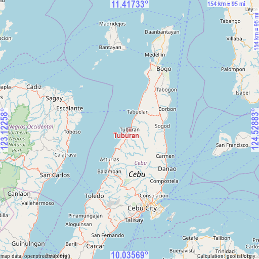
Tuburan GPS coordinates[2]
10° 43' 38.28" North, 123° 49' 32.52" East
| Map corner | latitude | longitude |
|---|---|---|
| Upper-left | 11.41733°, | 123.12258° |
| Center: | 10.7273°, | 123.8257° |
| Lower-right: | 10.03569°, | 124.52883° |
| Map W x H: | 153.6×153.6 km | = 95.4×95.4mi |
| max Lat: | 20.78733° ⇑60.5% North |
| Tuburan: | 10.7273° |
| min Lat: | ⇓39.5% South 4.65442° |
| min Long | Tuburan | max Long |
| 117.04868° | 123.8257° | 126.58417° |
| W 68.2%⇐ | ⇒31.8% E |
Elevation
Elevation of Tuburan is 0 m = 0 ft, and this is 87.9 m = 288 ft below average elevation for this country.
| Max E: |
2262 m = 7421 ft | 100% |
| Avg. | 87.9 m = 288 ft | |
| Tuburan | 0 m = 0 ft | |
Min E: |
-2 m = -7 ft | 0% |
See also: Philippines elevation on elevation.city.
Geographical zone
Tuburan is located in North Torrid zone (between Equator and Tropic of Cancer). Distance of Equator is 1192.8 km =741.2 mi to South.| Distance of | km | miles | from Tuburan |
|---|---|---|---|
| North Pole | 8814.3 | 5477 | to North |
| Arctic Circle | 6208.4 | 3857.7 | to North |
| Tropic Cancer | 1413.2 | 878.1 | to North |
| Equator | 1192.8 | 741.2 | to South |


Nearby cities:
15 places around Tuburan: (largest is in red/bold)
• Cabalawan
13.9 km =8.6 mi,  83°
83°
• Carmelo
4.3 km =2.7 mi,  234°
234°
• Catmon
19.1 km =11.9 mi,  93°
93°
• Cogon
1.6 km =1 mi,  169°
169°
• Colonia
8.9 km =5.5 mi,  205°
205°
• Langob
19.6 km =12.2 mi, 211°
• Lugo
20.2 km =12.6 mi,  60°
60°
• Lunas
12.6 km =7.8 mi,  219°
219°
• Putat
6.9 km =4.3 mi,  19°
19°
• San Roque
16.3 km =10.1 mi, 213°
• Santa Nino
5.9 km =3.7 mi, 223°
• Sogod
18.6 km =11.6 mi, 81°
• Tabonok
14.9 km =9.3 mi, 21°
• Tabuelan
11.4 km =7.1 mi, 24°
• Tubigagmanoc
13.9 km =8.6 mi, 217°
Sources, notices
• [Note1] Compared only with cities in Philippines existing in our database
• [Src1] Map data: © OpenStreetMap contributors (CC-BY-SA)
• [Src2] Other city data from geonames.org with taken over terms of usage.
• [Src3] Geographical zone / Annual Mean Temperature by Robert A. Rohde @ Wikipedia
