Tabonok geodata
Tabonok (Central Visayas) is a populated place; located in Philippines in Asia/Manila (GMT+8) time zone. With population of 2,822 people, there are 2754 cities with bigger population in this country. Compared to other cities in Philippines, 58.7% of cities are located further ↑North; 69.1% of cities are located further ←West and 85.4% of cities have higher elevation than Tabonok. Note1


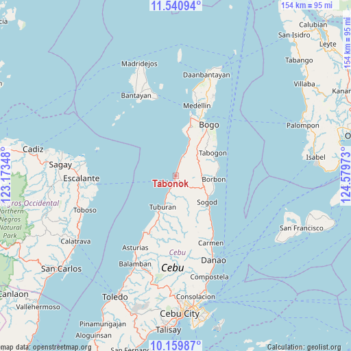
Tabonok GPS coordinates[2]
10° 51' 4.32" North, 123° 52' 35.76" East
| Map corner | latitude | longitude |
|---|---|---|
| Upper-left | 11.54094°, | 123.17348° |
| Center: | 10.8512°, | 123.8766° |
| Lower-right: | 10.15987°, | 124.57973° |
| Map W x H: | 153.6×153.6 km | = 95.4×95.4mi |
| max Lat: | 20.78733° ⇑58.7% North |
| Tabonok: | 10.8512° |
| min Lat: | ⇓41.3% South 4.65442° |
| min Long | Tabonok | max Long |
| 117.04868° | 123.8766° | 126.58417° |
| W 69.1%⇐ | ⇒30.9% E |
Elevation
Elevation of Tabonok is 8 m = 26 ft, and this is 79.9 m = 262 ft below average elevation for this country.
| Max E: |
2262 m = 7421 ft | 85.4% |
| Avg. | 87.9 m = 288 ft | |
| Tabonok | 8 m = 26 ft | |
Min E: |
-2 m = -7 ft | 14.6% |
See also: Philippines elevation on elevation.city.
Geographical zone
Tabonok is located in North Torrid zone (between Equator and Tropic of Cancer). Distance of Equator is 1206.5 km =749.7 mi to South.| Distance of | km | miles | from Tabonok |
|---|---|---|---|
| North Pole | 8800.5 | 5468.4 | to North |
| Arctic Circle | 6194.6 | 3849.1 | to North |
| Tropic Cancer | 1399.4 | 869.5 | to North |
| Equator | 1206.5 | 749.7 | to South |


Nearby cities:
15 places around Tabonok: (largest is in red/bold)
• Borbon
16.8 km =10.4 mi,  95°
95°
• Cabalawan
14.8 km =9.2 mi,  145°
145°
• Campusong
17.4 km =10.8 mi, 103°
• Cogon
16.2 km =10.1 mi,  198°
198°
• Damolog
16.6 km =10.3 mi,  121°
121°
• Ilihan
11.9 km =7.4 mi,  59°
59°
• Lugo
12.6 km =7.8 mi,  107°
107°
• Maravilla
5.8 km =3.6 mi,  16°
16°
• Putat
8 km =5 mi, 204°
• Sogod
17.1 km =10.6 mi,  130°
130°
• Tabuelan
3.5 km =2.2 mi,  194°
194°
• Tabunok
17.3 km =10.7 mi, 118°
• Tambongon
14 km =8.7 mi, 21°
• Taytayan
11.4 km =7.1 mi,  74°
74°
• Tuburan
14.9 km =9.3 mi, 201°
Sources, notices
• [Note1] Compared only with cities in Philippines existing in our database
• [Src1] Map data: © OpenStreetMap contributors (CC-BY-SA)
• [Src2] Other city data from geonames.org with taken over terms of usage.
• [Src3] Geographical zone / Annual Mean Temperature by Robert A. Rohde @ Wikipedia
