Tubungan geodata
Tubungan (Western Visayas) is a seat of a third-order administrative division; located in Philippines in Asia/Manila (GMT+8) time zone. In our database, there are 4166 cities with bigger population. Compared to other cities in Philippines, 60.1% of cities are located further ↑North; 57.1% of cities are located further →East and 81.7% of cities have lower elevation than Tubungan. Note1


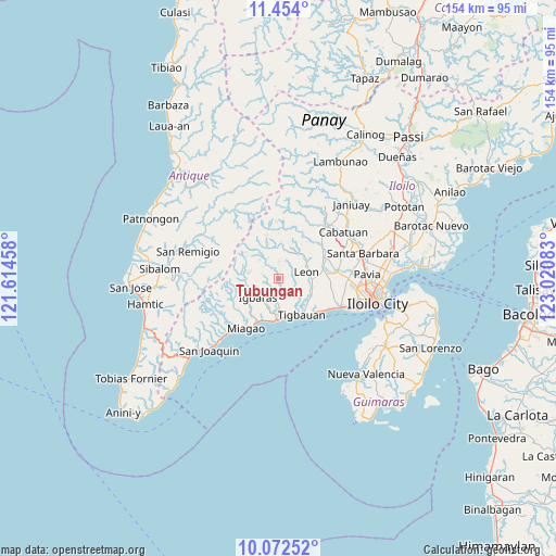
Tubungan GPS coordinates[2]
10° 45' 50.58" North, 122° 19' 3.72" East
| Map corner | latitude | longitude |
|---|---|---|
| Upper-left | 11.454°, | 121.61458° |
| Center: | 10.76405°, | 122.3177° |
| Lower-right: | 10.07252°, | 123.02083° |
| Map W x H: | 153.6×153.6 km | = 95.4×95.4mi |
| max Lat: | 20.78733° ⇑60.1% North |
| Tubungan: | 10.76405° |
| min Lat: | ⇓39.9% South 4.65442° |
| min Long | Tubungan | max Long |
| 117.04868° | 122.3177° | 126.58417° |
| W 42.9%⇐ | ⇒57.1% E |
Elevation
Elevation of Tubungan is 104 m = 341 ft, and this is 16.1 m = 53 ft above average elevation for this country.
| Max E: |
2262 m = 7421 ft | 18.3% |
| Tubungan | 104 m 341 ft | |
| Avg. | 87.9 m = 288 ft | |
Min E: |
-2 m = -7 ft | 81.7% |
See also: Philippines elevation on elevation.city.
Geographical zone
Tubungan is located in North Torrid zone (between Equator and Tropic of Cancer). Distance of Equator is 1196.9 km =743.7 mi to South.| Distance of | km | miles | from Tubungan |
|---|---|---|---|
| North Pole | 8810.2 | 5474.4 | to North |
| Arctic Circle | 6204.3 | 3855.2 | to North |
| Tropic Cancer | 1409.1 | 875.6 | to North |
| Equator | 1196.9 | 743.7 | to South |


Nearby cities:
15 places around Tubungan: (largest is in red/bold)
• Alimodian
13.9 km =8.6 mi,  62°
62°
• Atabayan
14.1 km =8.8 mi,  129°
129°
• Buga
7.7 km =4.8 mi,  226°
226°
• Buyuan
11.2 km =7 mi,  157°
157°
• Cordova
9.9 km =6.2 mi,  112°
112°
• Guimbal
11.2 km =7 mi,  177°
177°
• Igbaras
7.8 km =4.8 mi, 226°
• Igcocolo
8.3 km =5.2 mi, 178°
• Leon
8.1 km =5 mi,  76°
76°
• Miagao
16.1 km =10 mi,  214°
214°
• Napnapan
10.3 km =6.4 mi, 126°
• San Antonio
15 km =9.3 mi,  74°
74°
• Santa Monica
15.1 km =9.4 mi,  101°
101°
• Tigbauan
11.9 km =7.4 mi,  146°
146°
• Trapiche
15.3 km =9.5 mi, 125°
Sources, notices
• [Note1] Compared only with cities in Philippines existing in our database
• [Src1] Map data: © OpenStreetMap contributors (CC-BY-SA)
• [Src2] Other city data from geonames.org with taken over terms of usage.
• [Src3] Geographical zone / Annual Mean Temperature by Robert A. Rohde @ Wikipedia
