Tominhao geodata
Tominhao (Central Visayas) is a section of populated place; located in Philippines in Asia/Manila (GMT+8) time zone. With population of 3,644 people, there are 1951 cities with bigger population in this country. Compared to other cities in Philippines, 54.1% of cities are located further ↑North; 71.9% of cities are located further ←West and 64.1% of cities have lower elevation than Tominhao. Note1
Administrative division(s):
- Level 1: Central Visayas
- Level 2: Province of Cebu
- Level 3: Daanbantayan


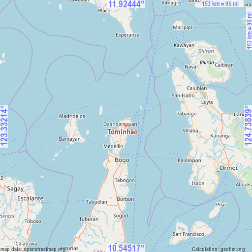
Tominhao GPS coordinates[2]
11° 14' 8.268" North, 124° 2' 6.936" East
| Map corner | latitude | longitude |
|---|---|---|
| Upper-left | 11.92444°, | 123.33214° |
| Center: | 11.23563°, | 124.03526° |
| Lower-right: | 10.54517°, | 124.73839° |
| Map W x H: | 153.4×153.4 km | = 95.3×95.3mi |
| max Lat: | 20.78733° ⇑54.1% North |
| Tominhao: | 11.23563° |
| min Lat: | ⇓45.9% South 4.65442° |
| min Long | Tominhao | max Long |
| 117.04868° | 124.03526° | 126.58417° |
| W 71.9%⇐ | ⇒28.1% E |
Elevation
Elevation of Tominhao is 40 m = 131 ft, and this is 47.9 m = 157 ft below average elevation for this country.
| Max E: |
2262 m = 7421 ft | 35.9% |
| Avg. | 87.9 m = 288 ft | |
| Tominhao | 40 m = 131 ft | |
Min E: |
-2 m = -7 ft | 64.1% |
See also: Philippines elevation on elevation.city.
Geographical zone
Tominhao is located in North Torrid zone (between Equator and Tropic of Cancer). Distance of Equator is 1249.3 km =776.3 mi to South.| Distance of | km | miles | from Tominhao |
|---|---|---|---|
| North Pole | 8757.8 | 5441.8 | to North |
| Arctic Circle | 6151.9 | 3822.6 | to North |
| Tropic Cancer | 1356.6 | 843 | to North |
| Equator | 1249.3 | 776.3 | to South |


Nearby cities:
15 places around Tominhao: (largest is in red/bold)
• Bachauan
8.5 km =5.3 mi,  247°
247°
• Bagay
4.4 km =2.7 mi,  180°
180°
• Bateria
10.5 km =6.5 mi,  185°
185°
• Biton
3.9 km =2.4 mi,  265°
265°
• Calape
6.7 km =4.2 mi, 181°
• Daanbantayan
2.6 km =1.6 mi,  298°
298°
• Kauit
11.2 km =7 mi,  240°
240°
• Lanao
2.6 km =1.6 mi,  332°
332°
• Maya
4.8 km =3 mi,  26°
26°
• Pajo
2.8 km =1.7 mi,  283°
283°
• Panognawan
8.8 km =5.5 mi,  201°
201°
• Paypay
6.8 km =4.2 mi, 250°
• Talisay
2.4 km =1.5 mi,  63°
63°
• Tapilon
4.7 km =2.9 mi,  353°
353°
• Tinubuan
6.3 km =3.9 mi,  208°
208°
Sources, notices
• [Note1] Compared only with cities in Philippines existing in our database
• [Src1] Map data: © OpenStreetMap contributors (CC-BY-SA)
• [Src2] Other city data from geonames.org with taken over terms of usage.
• [Src3] Geographical zone / Annual Mean Temperature by Robert A. Rohde @ Wikipedia
