Tandayag geodata
Tandayag (Central Visayas) is a populated place; located in Philippines in Asia/Manila (GMT+8) time zone. With population of 3,533 people, there are 2033 cities with bigger population in this country. Compared to other cities in Philippines, 73.4% of cities are located further ↑North; 57% of cities are located further ←West and 53.5% of cities have lower elevation than Tandayag. Note1
Administrative division(s):
- Level 1: Central Visayas
- Level 2: Province of Negros Oriental
- Level 3: Amlan (Ayuquitan)


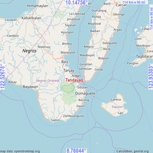
Tandayag GPS coordinates[2]
9° 27' 16.92" North, 123° 13' 47.64" East
| Map corner | latitude | longitude |
|---|---|---|
| Upper-left | 10.14756°, | 122.52678° |
| Center: | 9.4547°, | 123.2299° |
| Lower-right: | 8.76044°, | 123.93303° |
| Map W x H: | 154.2×154.2 km | = 95.8×95.8mi |
| max Lat: | 20.78733° ⇑73.4% North |
| Tandayag: | 9.4547° |
| min Lat: | ⇓26.6% South 4.65442° |
| min Long | Tandayag | max Long |
| 117.04868° | 123.2299° | 126.58417° |
| W 57%⇐ | ⇒43% E |
Elevation
Elevation of Tandayag is 26 m = 85 ft, and this is 61.9 m = 203 ft below average elevation for this country.
| Max E: |
2262 m = 7421 ft | 46.5% |
| Avg. | 87.9 m = 288 ft | |
| Tandayag | 26 m = 85 ft | |
Min E: |
-2 m = -7 ft | 53.5% |
See also: Philippines elevation on elevation.city.
Geographical zone
Tandayag is located in North Torrid zone (between Equator and Tropic of Cancer). Distance of Equator is 1051.3 km =653.2 mi to South.| Distance of | km | miles | from Tandayag |
|---|---|---|---|
| North Pole | 8955.8 | 5564.9 | to North |
| Arctic Circle | 6349.9 | 3945.6 | to North |
| Tropic Cancer | 1554.7 | 966 | to North |
| Equator | 1051.3 | 653.2 | to South |


Nearby cities:
15 places around Tandayag: (largest is in red/bold)
• Azagra
10.5 km =6.5 mi,  284°
284°
• Datagon
15.5 km =9.6 mi,  266°
266°
• Jantianon
7.1 km =4.4 mi,  260°
260°
• Jugno
3.2 km =2 mi,  297°
297°
• Mainit
14.4 km =8.9 mi,  99°
99°
• Novallas
13.4 km =8.3 mi, 298°
• Okiot
14.3 km =8.9 mi,  330°
330°
• Pamplona
12.3 km =7.6 mi, 279°
• Polo
6.2 km =3.9 mi, 298°
• Samboan
11.7 km =7.3 mi,  46°
46°
• San Jose
4.8 km =3 mi,  169°
169°
• Santander Poblacion
12.4 km =7.7 mi,  105°
105°
• Sibulan
12.3 km =7.6 mi,  150°
150°
• Silab
5.9 km =3.7 mi,  251°
251°
• Tanjay
10.4 km =6.5 mi,  310°
310°
Sources, notices
• [Note1] Compared only with cities in Philippines existing in our database
• [Src1] Map data: © OpenStreetMap contributors (CC-BY-SA)
• [Src2] Other city data from geonames.org with taken over terms of usage.
• [Src3] Geographical zone / Annual Mean Temperature by Robert A. Rohde @ Wikipedia
