Tambo geodata
Tambo (Bicol) is a populated place; located in Philippines in Asia/Manila (GMT+8) time zone. With population of 2,989 people, there are 2540 cities with bigger population in this country. Compared to other cities in Philippines, 59.4% of cities are located further ↓South; 58.1% of cities are located further ←West and 80.7% of cities have higher elevation than Tambo. Note1


Tambo GPS coordinates[2]
13° 15' 19.08" North, 123° 17' 26.16" East
| Map corner | latitude | longitude |
|---|---|---|
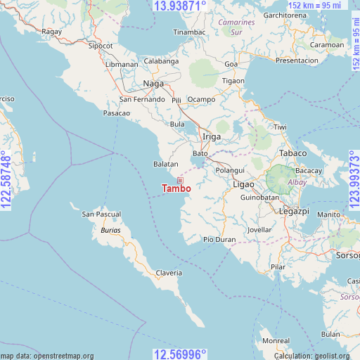
| Upper-left | 13.93871°, | 122.58748° |
| Center: | 13.2553°, | 123.2906° |
| Lower-right: | 12.56996°, | 123.99373° |
| Map W x H: | 152.2×152.2 km | = 94.6×94.6mi |
| max Lat: | 20.78733° ⇑40.6% North |
| Tambo: | 13.2553° |
| min Lat: | ⇓59.4% South 4.65442° |
| min Long | Tambo | max Long |
| 117.04868° | 123.2906° | 126.58417° |
| W 58.1%⇐ | ⇒41.9% E |
Elevation
Elevation of Tambo is 9 m = 30 ft, and this is 78.9 m = 259 ft below average elevation for this country.
| Max E: |
2262 m = 7421 ft | 80.7% |
| Avg. | 87.9 m = 288 ft | |
| Tambo | 9 m = 30 ft | |
Min E: |
-2 m = -7 ft | 19.3% |
See also: Philippines elevation on elevation.city.
Geographical zone
Tambo is located in North Torrid zone (between Equator and Tropic of Cancer). Distance of this Northern Tropic circle is 1132.1 km =703.5 mi to North.| Distance of | km | miles | from Tambo |
|---|---|---|---|
| North Pole | 8533.2 | 5302.3 | to North |
| Arctic Circle | 5927.3 | 3683.1 | to North |
| Tropic Cancer | 1132.1 | 703.5 | to North |
| Equator | 1473.9 | 915.8 | to South |


Nearby cities:
15 places around Tambo: (largest is in red/bold)
• Agos
15.2 km =9.4 mi,  49°
49°
• Apud
12.9 km =8 mi,  179°
179°
• Balatan
9.6 km =6 mi,  319°
319°
• Bato
13.7 km =8.5 mi,  37°
37°
• Buga
8.8 km =5.5 mi,  58°
58°
• Buluang
8 km =5 mi, 44°
• Burabod
13.7 km =8.5 mi,  83°
83°
• Del Rosario
6.1 km =3.8 mi,  23°
23°
• Macabugos
2.7 km =1.7 mi,  143°
143°
• Malawag
14.3 km =8.9 mi,  356°
356°
• Masoli
15.8 km =9.8 mi, 42°
• Pantao
7.8 km =4.8 mi,  149°
149°
• Sagrada Familia
11.7 km =7.3 mi, 82°
• San Jose
8.8 km =5.5 mi,  96°
96°
• San Vicente
15.5 km =9.6 mi,  87°
87°
Sources, notices
• [Note1] Compared only with cities in Philippines existing in our database
• [Src1] Map data: © OpenStreetMap contributors (CC-BY-SA)
• [Src2] Other city data from geonames.org with taken over terms of usage.
• [Src3] Geographical zone / Annual Mean Temperature by Robert A. Rohde @ Wikipedia
