Talomo geodata
Talomo (Davao) is a populated place; located in Philippines in Asia/Manila (GMT+8) time zone. With population of 3,857 people, there are 1804 cities with bigger population in this country. Compared to other cities in Philippines, 86.7% of cities are located further ↑North; 96% of cities are located further ←West and 57.6% of cities have higher elevation than Talomo. Note1
Administrative division(s):
- Level 1: Davao
- Level 2: Province of Davao del Norte
- Level 3: Santo Tomas


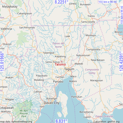
Talomo GPS coordinates[2]
7° 31' 42.996" North, 125° 43' 22.008" East
| Map corner | latitude | longitude |
|---|---|---|
| Upper-left | 8.2251°, | 125.01966° |
| Center: | 7.52861°, | 125.72278° |
| Lower-right: | 6.831°, | 126.42591° |
| Map W x H: | 155×155 km | = 96.3×96.3mi |
| max Lat: | 20.78733° ⇑86.7% North |
| Talomo: | 7.52861° |
| min Lat: | ⇓13.3% South 4.65442° |
| min Long | Talomo | max Long |
| 117.04868° | 125.72278° | 126.58417° |
| W 96%⇐ | ⇒4% E |
Elevation
Elevation of Talomo is 18 m = 59 ft, and this is 69.9 m = 229 ft below average elevation for this country.
| Max E: |
2262 m = 7421 ft | 57.6% |
| Avg. | 87.9 m = 288 ft | |
| Talomo | 18 m = 59 ft | |
Min E: |
-2 m = -7 ft | 42.4% |
See also: Philippines elevation on elevation.city.
Geographical zone
Talomo is located in North Torrid zone (between Equator and Tropic of Cancer). Distance of Equator is 837.1 km =520.1 mi to South.| Distance of | km | miles | from Talomo |
|---|---|---|---|
| North Pole | 9170 | 5698 | to North |
| Arctic Circle | 6564.1 | 4078.7 | to North |
| Tropic Cancer | 1768.8 | 1099.1 | to North |
| Equator | 837.1 | 520.1 | to South |


Nearby cities:
15 places around Talomo: (largest is in red/bold)
• Buclad
3.1 km =1.9 mi,  91°
91°
• Cambanugoy
3.9 km =2.4 mi,  68°
68°
• Esperanza
4.1 km =2.5 mi,  171°
171°
• Gabuyan
10.6 km =6.6 mi,  326°
326°
• Kinamayan
6.3 km =3.9 mi,  239°
239°
• La Libertad
9.9 km =6.2 mi, 237°
• Luna
8.1 km =5 mi,  310°
310°
• Lungaog
3.9 km =2.4 mi,  271°
271°
• Magatos
3 km =1.9 mi,  8°
8°
• New Leyte
4.4 km =2.7 mi,  136°
136°
• New Visayas
11 km =6.8 mi, 266°
• Pag-asa
6.8 km =4.2 mi,  320°
320°
• Pagsabangan
6 km =3.7 mi,  150°
150°
• Sampao
9.9 km =6.2 mi, 316°
• San Miguel
7 km =4.3 mi,  226°
226°
Sources, notices
• [Note1] Compared only with cities in Philippines existing in our database
• [Src1] Map data: © OpenStreetMap contributors (CC-BY-SA)
• [Src2] Other city data from geonames.org with taken over terms of usage.
• [Src3] Geographical zone / Annual Mean Temperature by Robert A. Rohde @ Wikipedia
