Buclad geodata
Buclad (Davao) is a populated place; located in Philippines in Asia/Manila (GMT+8) time zone. With population of 2,620 people, there are 3076 cities with bigger population in this country. Compared to other cities in Philippines, 86.7% of cities are located further ↑North; 96.3% of cities are located further ←West and 62.8% of cities have higher elevation than Buclad. Note1
Administrative division(s):
- Level 1: Davao
- Level 2: Province of Davao del Norte
- Level 3: Asuncion (Saug)


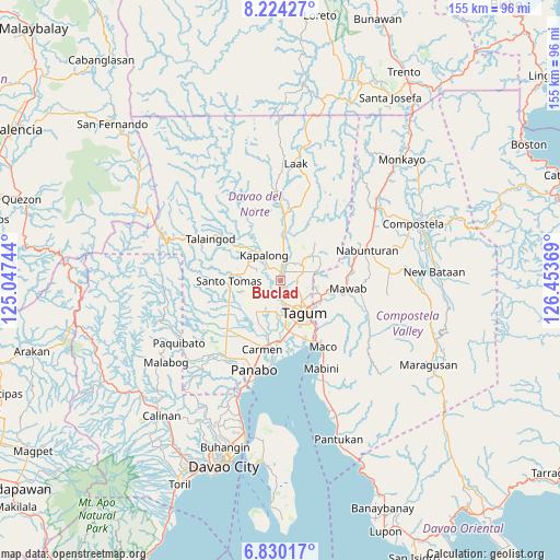
Buclad GPS coordinates[2]
7° 31' 40.008" North, 125° 45' 2.016" East
| Map corner | latitude | longitude |
|---|---|---|
| Upper-left | 8.22427°, | 125.04744° |
| Center: | 7.52778°, | 125.75056° |
| Lower-right: | 6.83017°, | 126.45369° |
| Map W x H: | 155×155 km | = 96.3×96.3mi |
| max Lat: | 20.78733° ⇑86.7% North |
| Buclad: | 7.52778° |
| min Lat: | ⇓13.3% South 4.65442° |
| min Long | Buclad | max Long |
| 117.04868° | 125.75056° | 126.58417° |
| W 96.3%⇐ | ⇒3.7% E |
Elevation
Elevation of Buclad is 15 m = 49 ft, and this is 72.9 m = 239 ft below average elevation for this country.
| Max E: |
2262 m = 7421 ft | 62.8% |
| Avg. | 87.9 m = 288 ft | |
| Buclad | 15 m = 49 ft | |
Min E: |
-2 m = -7 ft | 37.2% |
See also: Philippines elevation on elevation.city.
Geographical zone
Buclad is located in North Torrid zone (between Equator and Tropic of Cancer). Distance of Equator is 837 km =520.1 mi to South.| Distance of | km | miles | from Buclad |
|---|---|---|---|
| North Pole | 9170.1 | 5698 | to North |
| Arctic Circle | 6564.2 | 4078.8 | to North |
| Tropic Cancer | 1768.9 | 1099.1 | to North |
| Equator | 837 | 520.1 | to South |


Nearby cities:
15 places around Buclad: (largest is in red/bold)
• Cambanugoy
1.6 km =1 mi,  19°
19°
• Del Pilar
9.3 km =5.8 mi,  64°
64°
• Esperanza
4.7 km =2.9 mi,  211°
211°
• Kinamayan
9 km =5.6 mi,  249°
249°
• Luna
10.7 km =6.6 mi,  300°
300°
• Lungaog
6.9 km =4.3 mi,  271°
271°
• Magatos
4.1 km =2.5 mi,  319°
319°
• Magugpo Poblacion
10.7 km =6.6 mi,  146°
146°
• New Bohol
9.5 km =5.9 mi,  93°
93°
• New Corella
10.4 km =6.5 mi,  50°
50°
• New Leyte
3.1 km =1.9 mi,  181°
181°
• Pag-asa
9.1 km =5.7 mi,  305°
305°
• Pagsabangan
5.2 km =3.2 mi, 181°
• San Miguel
9.5 km =5.9 mi,  239°
239°
• Talomo
3.1 km =1.9 mi, 271°
Sources, notices
• [Note1] Compared only with cities in Philippines existing in our database
• [Src1] Map data: © OpenStreetMap contributors (CC-BY-SA)
• [Src2] Other city data from geonames.org with taken over terms of usage.
• [Src3] Geographical zone / Annual Mean Temperature by Robert A. Rohde @ Wikipedia
