New Visayas geodata
New Visayas (Davao) is a populated place; located in Philippines in Asia/Manila (GMT+8) time zone. With population of 14,758 people, there are 453 cities with bigger population in this country. Compared to other cities in Philippines, 86.7% of cities are located further ↑North; 94.8% of cities are located further ←West and 65.9% of cities have lower elevation than New Visayas. Note1
Administrative division(s):
- Level 1: Davao
- Level 2: Province of Davao del Norte
- Level 3: Santo Tomas


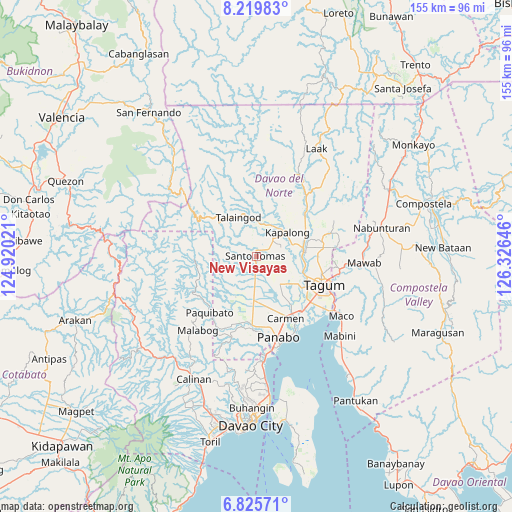
New Visayas GPS coordinates[2]
7° 31' 23.988" North, 125° 37' 23.988" East
| Map corner | latitude | longitude |
|---|---|---|
| Upper-left | 8.21983°, | 124.92021° |
| Center: | 7.52333°, | 125.62333° |
| Lower-right: | 6.82571°, | 126.32646° |
| Map W x H: | 155×155 km | = 96.3×96.3mi |
| max Lat: | 20.78733° ⇑86.7% North |
| New Visayas: | 7.52333° |
| min Lat: | ⇓13.3% South 4.65442° |
| min Long | New Visayas | max Long |
| 117.04868° | 125.62333° | 126.58417° |
| W 94.8%⇐ | ⇒5.2% E |
Elevation
Elevation of New Visayas is 43 m = 141 ft, and this is 44.9 m = 147 ft below average elevation for this country.
| Max E: |
2262 m = 7421 ft | 34.1% |
| Avg. | 87.9 m = 288 ft | |
| New Visayas | 43 m = 141 ft | |
Min E: |
-2 m = -7 ft | 65.9% |
See also: Philippines elevation on elevation.city.
Geographical zone
New Visayas is located in North Torrid zone (between Equator and Tropic of Cancer). Distance of Equator is 836.5 km =519.8 mi to South.| Distance of | km | miles | from New Visayas |
|---|---|---|---|
| North Pole | 9170.5 | 5698.3 | to North |
| Arctic Circle | 6564.7 | 4079.1 | to North |
| Tropic Cancer | 1769.4 | 1099.5 | to North |
| Equator | 836.5 | 519.8 | to South |


Nearby cities:
15 places around New Visayas: (largest is in red/bold)
• Balagunan
11.8 km =7.3 mi,  252°
252°
• Esperanza
12.1 km =7.5 mi,  106°
106°
• Gabuyan
10.7 km =6.6 mi,  28°
28°
• Kinamayan
6.1 km =3.8 mi,  115°
115°
• La Libertad
5.5 km =3.4 mi,  151°
151°
• Luna
7.6 km =4.7 mi,  39°
39°
• Lungaog
7.1 km =4.4 mi,  84°
84°
• Magatos
11.9 km =7.4 mi,  72°
72°
• Pag-asa
8.8 km =5.5 mi,  48°
48°
• Palma Gil
13.2 km =8.2 mi,  2°
2°
• Sampao
8.9 km =5.5 mi, 27°
• San Miguel
7.2 km =4.5 mi,  126°
126°
• Santo Niño
11.2 km =7 mi, 1°
• Santo Tomas
1.1 km =0.7 mi, 0°
• Talomo
11 km =6.8 mi,  86°
86°
Sources, notices
• [Note1] Compared only with cities in Philippines existing in our database
• [Src1] Map data: © OpenStreetMap contributors (CC-BY-SA)
• [Src2] Other city data from geonames.org with taken over terms of usage.
• [Src3] Geographical zone / Annual Mean Temperature by Robert A. Rohde @ Wikipedia
