Lucap geodata
Lucap (Ilocos) is a populated place; located in Philippines in Asia/Manila (GMT+8) time zone. With population of 4,935 people, there are 1319 cities with bigger population in this country. Compared to other cities in Philippines, 89.3% of cities are located further ↓South; 97% of cities are located further →East and 85.4% of cities have higher elevation than Lucap. Note1
Administrative division(s):
- Level 1: Ilocos
- Level 2: Province of Pangasinan
- Level 3: City of Alaminos


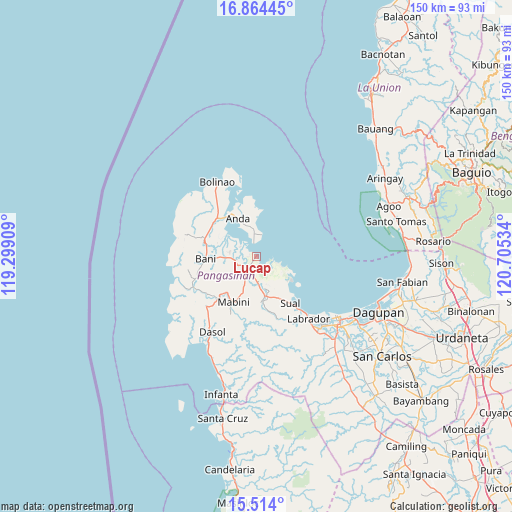
Lucap GPS coordinates[2]
16° 11' 25.368" North, 120° 0' 7.956" East
| Map corner | latitude | longitude |
|---|---|---|
| Upper-left | 16.86445°, | 119.29909° |
| Center: | 16.19038°, | 120.00221° |
| Lower-right: | 15.514°, | 120.70534° |
| Map W x H: | 150.2×150.2 km | = 93.3×93.3mi |
| max Lat: | 20.78733° ⇑10.7% North |
| Lucap: | 16.19038° |
| min Lat: | ⇓89.3% South 4.65442° |
| min Long | Lucap | max Long |
| 117.04868° | 120.00221° | 126.58417° |
| W 3%⇐ | ⇒97% E |
Elevation
Elevation of Lucap is 8 m = 26 ft, and this is 79.9 m = 262 ft below average elevation for this country.
| Max E: |
2262 m = 7421 ft | 85.4% |
| Avg. | 87.9 m = 288 ft | |
| Lucap | 8 m = 26 ft | |
Min E: |
-2 m = -7 ft | 14.6% |
See also: Philippines elevation on elevation.city.
Geographical zone
Lucap is located in North Torrid zone (between Equator and Tropic of Cancer). Distance of this Northern Tropic circle is 805.7 km =500.6 mi to North.| Distance of | km | miles | from Lucap |
|---|---|---|---|
| North Pole | 8206.9 | 5099.5 | to North |
| Arctic Circle | 5601 | 3480.3 | to North |
| Tropic Cancer | 805.7 | 500.6 | to North |
| Equator | 1800.2 | 1118.6 | to South |


Nearby cities:
15 places around Lucap: (largest is in red/bold)
• Alaminos
4.4 km =2.7 mi,  210°
210°
• Anda
12.3 km =7.6 mi,  333°
333°
• Banog Sur
11.5 km =7.1 mi,  255°
255°
• Bued
3.3 km =2.1 mi,  186°
186°
• Caabiangan
14.1 km =8.8 mi,  215°
215°
• Mabini
15 km =9.3 mi, 206°
• Paitan Este
12.1 km =7.5 mi,  164°
164°
• Pangapisan
5.6 km =3.5 mi,  300°
300°
• Pangascasan
12.2 km =7.6 mi,  132°
132°
• Polo
5.7 km =3.5 mi,  276°
276°
• Sablig
8.9 km =5.5 mi,  349°
349°
• Tagudin
13.3 km =8.3 mi,  202°
202°
• Telbang
6.6 km =4.1 mi,  107°
107°
• Tondol
13.4 km =8.3 mi,  4°
4°
• Toritori
5.4 km =3.4 mi, 352°
Sources, notices
• [Note1] Compared only with cities in Philippines existing in our database
• [Src1] Map data: © OpenStreetMap contributors (CC-BY-SA)
• [Src2] Other city data from geonames.org with taken over terms of usage.
• [Src3] Geographical zone / Annual Mean Temperature by Robert A. Rohde @ Wikipedia
