Tagana-an geodata
Tagana-an (Caraga) is a seat of a third-order administrative division; located in Philippines in Asia/Manila (GMT+8) time zone. With population of 4,386 people, there are 1546 cities with bigger population in this country. Compared to other cities in Philippines, 71.6% of cities are located further ↑North; 94.4% of cities are located further ←West and 89.7% of cities have higher elevation than Tagana-an. Note1
Administrative division(s):
- Level 1: Caraga
- Level 2: Province of Surigao del Norte
- Level 3: Tagana-An


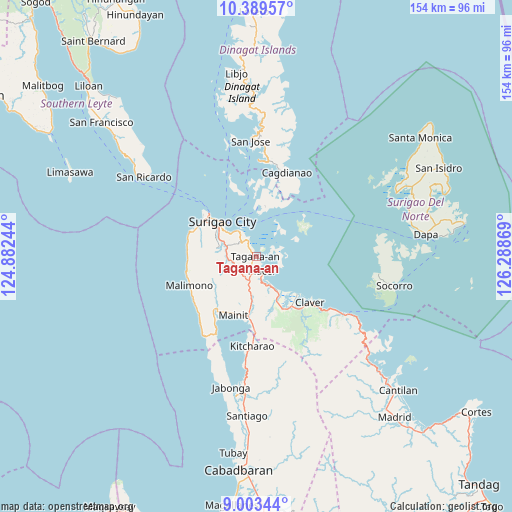
Tagana-an GPS coordinates[2]
9° 41' 49.992" North, 125° 35' 8.016" East
| Map corner | latitude | longitude |
|---|---|---|
| Upper-left | 10.38957°, | 124.88244° |
| Center: | 9.69722°, | 125.58556° |
| Lower-right: | 9.00344°, | 126.28869° |
| Map W x H: | 154.1×154.1 km | = 95.8×95.8mi |
| max Lat: | 20.78733° ⇑71.6% North |
| Tagana-an: | 9.69722° |
| min Lat: | ⇓28.4% South 4.65442° |
| min Long | Tagana-an | max Long |
| 117.04868° | 125.58556° | 126.58417° |
| W 94.4%⇐ | ⇒5.6% E |
Elevation
Elevation of Tagana-an is 7 m = 23 ft, and this is 80.9 m = 265 ft below average elevation for this country.
| Max E: |
2262 m = 7421 ft | 89.7% |
| Avg. | 87.9 m = 288 ft | |
| Tagana-an | 7 m = 23 ft | |
Min E: |
-2 m = -7 ft | 10.3% |
See also: Philippines elevation on elevation.city.
Geographical zone
Tagana-an is located in North Torrid zone (between Equator and Tropic of Cancer). Distance of Equator is 1078.2 km =670 mi to South.| Distance of | km | miles | from Tagana-an |
|---|---|---|---|
| North Pole | 8928.8 | 5548.1 | to North |
| Arctic Circle | 6322.9 | 3928.9 | to North |
| Tropic Cancer | 1527.7 | 949.3 | to North |
| Equator | 1078.2 | 670 | to South |


Nearby cities:
15 places around Tagana-an: (largest is in red/bold)
• Bacuag
11.5 km =7.1 mi,  149°
149°
• Capalayan
6.6 km =4.1 mi,  316°
316°
• Gigaquit
16.8 km =10.4 mi,  132°
132°
• Ipil
19.2 km =11.9 mi,  302°
302°
• Luna
10.6 km =6.6 mi,  294°
294°
• Mabua
19.8 km =12.3 mi,  306°
306°
• Mainit
19.3 km =12 mi,  200°
200°
• Mati
13.6 km =8.5 mi, 288°
• Placer
5.1 km =3.2 mi,  158°
158°
• Rizal
16.2 km =10.1 mi, 304°
• San Francisco
19.7 km =12.2 mi, 296°
• Sison
7.5 km =4.7 mi,  236°
236°
• Surigao
14.2 km =8.8 mi, 315°
• Talisay
13.9 km =8.6 mi,  13°
13°
• Tubod
15.1 km =9.4 mi,  186°
186°
Sources, notices
• [Note1] Compared only with cities in Philippines existing in our database
• [Src1] Map data: © OpenStreetMap contributors (CC-BY-SA)
• [Src2] Other city data from geonames.org with taken over terms of usage.
• [Src3] Geographical zone / Annual Mean Temperature by Robert A. Rohde @ Wikipedia
