Mainit geodata
Mainit (Caraga) is a seat of a third-order administrative division; located in Philippines in Asia/Manila (GMT+8) time zone. With population of 5,520 people, there are 1152 cities with bigger population in this country. Compared to other cities in Philippines, 73% of cities are located further ↑North; 93.7% of cities are located further ←West and 65.2% of cities have lower elevation than Mainit. Note1


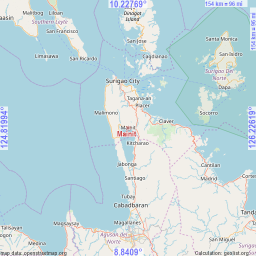
Mainit GPS coordinates[2]
9° 32' 6" North, 125° 31' 23.016" East
| Map corner | latitude | longitude |
|---|---|---|
| Upper-left | 10.22769°, | 124.81994° |
| Center: | 9.535°, | 125.52306° |
| Lower-right: | 8.8409°, | 126.22619° |
| Map W x H: | 154.2×154.2 km | = 95.8×95.8mi |
| max Lat: | 20.78733° ⇑73% North |
| Mainit: | 9.535° |
| min Lat: | ⇓27% South 4.65442° |
| min Long | Mainit | max Long |
| 117.04868° | 125.52306° | 126.58417° |
| W 93.7%⇐ | ⇒6.3% E |
Elevation
Elevation of Mainit is 42 m = 138 ft, and this is 45.9 m = 151 ft below average elevation for this country.
| Max E: |
2262 m = 7421 ft | 34.8% |
| Avg. | 87.9 m = 288 ft | |
| Mainit | 42 m = 138 ft | |
Min E: |
-2 m = -7 ft | 65.2% |
See also: Philippines elevation on elevation.city.
Geographical zone
Mainit is located in North Torrid zone (between Equator and Tropic of Cancer). Distance of Equator is 1060.2 km =658.8 mi to South.| Distance of | km | miles | from Mainit |
|---|---|---|---|
| North Pole | 8946.9 | 5559.3 | to North |
| Arctic Circle | 6341 | 3940.1 | to North |
| Tropic Cancer | 1545.7 | 960.5 | to North |
| Equator | 1060.2 | 658.8 | to South |


Nearby cities:
15 places around Mainit: (largest is in red/bold)
• Alegria
9.6 km =6 mi,  141°
141°
• Bacuag
15.1 km =9.4 mi,  57°
57°
• Cantapoy
10.7 km =6.6 mi,  242°
242°
• Capalayan
23 km =14.3 mi,  5°
5°
• Gigaquit
20.2 km =12.6 mi,  70°
70°
• Jabonga
21.4 km =13.3 mi,  182°
182°
• Kitcharao
10.4 km =6.5 mi,  148°
148°
• Luna
22.6 km =14 mi,  352°
352°
• Malimono
16.2 km =10.1 mi,  304°
304°
• Mati
23.1 km =14.4 mi,  344°
344°
• Placer
15.9 km =9.9 mi,  33°
33°
• San Francisco
4.2 km =2.6 mi,  259°
259°
• Sison
13.9 km =8.6 mi,  2°
2°
• Tagana-an
19.3 km =12 mi,  20°
20°
• Tubod
6.1 km =3.8 mi, 59°
Sources, notices
• [Note1] Compared only with cities in Philippines existing in our database
• [Src1] Map data: © OpenStreetMap contributors (CC-BY-SA)
• [Src2] Other city data from geonames.org with taken over terms of usage.
• [Src3] Geographical zone / Annual Mean Temperature by Robert A. Rohde @ Wikipedia
