Salunayan geodata
Salunayan (Soccsksargen) is a populated place; located in Philippines in Asia/Manila (GMT+8) time zone. With population of 2,758 people, there are 2858 cities with bigger population in this country. Compared to other cities in Philippines, 90% of cities are located further ↑North; 78.8% of cities are located further ←West and 59.2% of cities have higher elevation than Salunayan. Note1


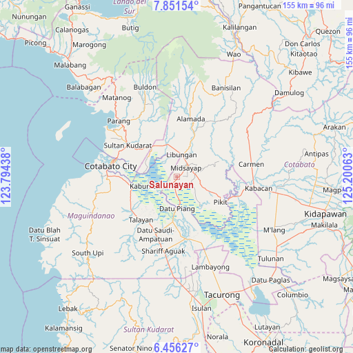
Salunayan GPS coordinates[2]
7° 9' 15.984" North, 124° 29' 51" East
| Map corner | latitude | longitude |
|---|---|---|
| Upper-left | 7.85154°, | 123.79438° |
| Center: | 7.15444°, | 124.4975° |
| Lower-right: | 6.45627°, | 125.20063° |
| Map W x H: | 155.1×155.1 km | = 96.4×96.4mi |
| max Lat: | 20.78733° ⇑90% North |
| Salunayan: | 7.15444° |
| min Lat: | ⇓10% South 4.65442° |
| min Long | Salunayan | max Long |
| 117.04868° | 124.4975° | 126.58417° |
| W 78.8%⇐ | ⇒21.2% E |
Elevation
Elevation of Salunayan is 17 m = 56 ft, and this is 70.9 m = 233 ft below average elevation for this country.
| Max E: |
2262 m = 7421 ft | 59.2% |
| Avg. | 87.9 m = 288 ft | |
| Salunayan | 17 m = 56 ft | |
Min E: |
-2 m = -7 ft | 40.8% |
See also: Philippines elevation on elevation.city.
Geographical zone
Salunayan is located in North Torrid zone (between Equator and Tropic of Cancer). Distance of Equator is 795.5 km =494.3 mi to South.| Distance of | km | miles | from Salunayan |
|---|---|---|---|
| North Pole | 9211.6 | 5723.8 | to North |
| Arctic Circle | 6605.7 | 4104.6 | to North |
| Tropic Cancer | 1810.4 | 1124.9 | to North |
| Equator | 795.5 | 494.3 | to South |


Nearby cities:
15 places around Salunayan: (largest is in red/bold)
• Baguer
11.3 km =7 mi,  3°
3°
• Bongued
11.5 km =7.1 mi,  248°
248°
• Bual
3.3 km =2.1 mi,  16°
16°
• Buayan
12.4 km =7.7 mi, 16°
• Budta
8.4 km =5.2 mi,  310°
310°
• Dado
12.3 km =7.6 mi,  199°
199°
• Dualing
7.8 km =4.8 mi,  92°
92°
• Glad
2.4 km =1.5 mi,  106°
106°
• Libungan
9.9 km =6.2 mi,  14°
14°
• Malingao
2.6 km =1.6 mi,  285°
285°
• Midsayap
5.4 km =3.4 mi,  41°
41°
• Pagangan
11.7 km =7.3 mi, 112°
• Patindeguen
7.3 km =4.5 mi, 0°
• Tomado
12.9 km =8 mi,  70°
70°
• Upper San Mateo
9.6 km =6 mi,  77°
77°
Sources, notices
• [Note1] Compared only with cities in Philippines existing in our database
• [Src1] Map data: © OpenStreetMap contributors (CC-BY-SA)
• [Src2] Other city data from geonames.org with taken over terms of usage.
• [Src3] Geographical zone / Annual Mean Temperature by Robert A. Rohde @ Wikipedia
