San Vicente geodata
San Vicente (Bicol) is a seat of a third-order administrative division; located in Philippines in Asia/Manila (GMT+8) time zone. With population of 4,523 people, there are 1480 cities with bigger population in this country. Compared to other cities in Philippines, 70.4% of cities are located further ↓South; 51.1% of cities are located further ←West and 64.1% of cities have lower elevation than San Vicente. Note1
Administrative division(s):
- Level 1: Bicol
- Level 2: Province of Camarines Norte
- Level 3: San Vicente


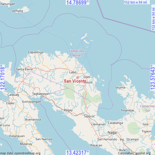
San Vicente GPS coordinates[2]
14° 6' 21.96" North, 122° 52' 23.88" East
| Map corner | latitude | longitude |
|---|---|---|
| Upper-left | 14.78699°, | 122.17018° |
| Center: | 14.1061°, | 122.8733° |
| Lower-right: | 13.42317°, | 123.57643° |
| Map W x H: | 151.6×151.6 km | = 94.2×94.2mi |
| max Lat: | 20.78733° ⇑29.6% North |
| San Vicente: | 14.1061° |
| min Lat: | ⇓70.4% South 4.65442° |
| min Long | San Vicente | max Long |
| 117.04868° | 122.8733° | 126.58417° |
| W 51.1%⇐ | ⇒48.9% E |
Elevation
Elevation of San Vicente is 40 m = 131 ft, and this is 47.9 m = 157 ft below average elevation for this country.
| Max E: |
2262 m = 7421 ft | 35.9% |
| Avg. | 87.9 m = 288 ft | |
| San Vicente | 40 m = 131 ft | |
Min E: |
-2 m = -7 ft | 64.1% |
See also: Philippines elevation on elevation.city.
Geographical zone
San Vicente is located in North Torrid zone (between Equator and Tropic of Cancer). Distance of this Northern Tropic circle is 1037.5 km =644.7 mi to North.| Distance of | km | miles | from San Vicente |
|---|---|---|---|
| North Pole | 8438.6 | 5243.5 | to North |
| Arctic Circle | 5832.7 | 3624.3 | to North |
| Tropic Cancer | 1037.5 | 644.7 | to North |
| Equator | 1568.5 | 974.6 | to South |


Nearby cities:
15 places around San Vicente: (largest is in red/bold)
• Basud
10.8 km =6.7 mi,  114°
114°
• Calasgasan
7 km =4.3 mi, 111°
• Daet
8.9 km =5.5 mi,  85°
85°
• Dugongan
3.6 km =2.2 mi,  96°
96°
• Guinacotan
5.7 km =3.5 mi,  354°
354°
• Imelda
8.2 km =5.1 mi,  172°
172°
• Labo
7 km =4.3 mi,  318°
318°
• Lugui
8.6 km =5.3 mi,  275°
275°
• Malasugui
5.1 km =3.2 mi,  326°
326°
• Mampurog
6.8 km =4.2 mi, 170°
• Matnog
7.8 km =4.8 mi,  124°
124°
• Santo Domingo
3.5 km =2.2 mi,  27°
27°
• Talisay
6.2 km =3.9 mi,  59°
59°
• Tulay na Lupa
9.5 km =5.9 mi,  261°
261°
• Vinzons
8.3 km =5.2 mi, 25°
Sources, notices
• [Note1] Compared only with cities in Philippines existing in our database
• [Src1] Map data: © OpenStreetMap contributors (CC-BY-SA)
• [Src2] Other city data from geonames.org with taken over terms of usage.
• [Src3] Geographical zone / Annual Mean Temperature by Robert A. Rohde @ Wikipedia
